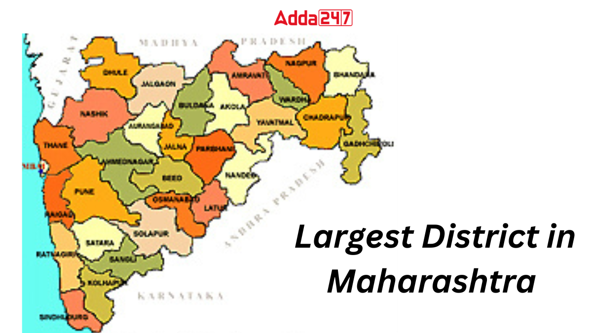
Maharashtra, a state known for its diverse landscapes and rich cultural heritage, houses a district that stands out for its sheer size and geographical significance. In this article, we delve into the largest district in Maharashtra, uncovering its unique features, historical importance, and the diverse communities that call it home.
How Many Districts are there in Maharashtra?
Maharashtra, currently comprising 36 districts, has undergone administrative evolution since its establishment on May 1, 1960. Initially established with 26 districts, the state later witnessed the formation of ten new districts. These districts are organized into six administrative units, each overseen by a Deputy Commissioner. This information provides an overview of the total districts in Maharashtra, including both the original and subsequently formed districts, along with insights into the administrative divisions they fall under.
Biggest District in Maharashtra By Area
Ahmednagar district, known as the largest district in Maharashtra by area, covers about 17,048 sq. km. Often called the “Land of Saints”, it is famous for religious places like Shirdi. The district has varied landscapes—cold and dry in the west, hot and dry in the east. Rivers like Godavari and Bhima support farming, with crops such as jowar and sugarcane. Ahmednagar also leads in the cooperative sector, along with steady growth in industries and agriculture.
Key Facts Related to Ahmednagar, Largest District in Maharashtra
Here are some of the key facts related to Ahmednagar, largest district in Maharashtra:
- Ahmednagar is the largest district in Maharashtra, covering 17,048 sq. km, and is renowned as the ‘Land of Saints.’
- Located in western Maharashtra, it is bordered by Nashik, Beed, Osmanabad, Aurangabad, Solapur, Thane, and Pune districts.
- The district has diverse landscapes, with cold and dry western regions and hot and dry eastern areas.
- Major rivers like Godavari and Bhima flow through Ahmednagar, contributing to its agricultural richness.
- With a population of 4,543,159 according to the 2011 census, Ahmednagar is a prominent district in Maharashtra.
- The district excels in cooperative initiatives, being home to India’s first cooperative sugar factory in Pravaranagar.
- Ahmednagar leads in sugar production in Maharashtra, with 20 sugar factories as of 2016.
- It boasts 100% electrification and a robust healthcare system with numerous hospitals and clinics.
- The district is a hub of education, hosting primary schools, secondary schools, high schools, and agricultural universities.
- Ahmednagar has a well-developed transportation network, with 197 km of Central Railway and extensive road connectivity through the Maharashtra State Transport Corporation.
- The district is known for its cooperative banking sector, with Central Bank of India and Ahmednagar District Central Co-operative Bank playing pivotal roles.
- Ahmednagar’s food market is famous in Maharashtra, and Ralegansiddhi in Parner taluka is recognized for its exemplary implementation of Adarsh Gram Yojana.
- The district is home to religious sites like Shirdi, Shree Dnyaneshwar Temple, Shani Shinganapur, Shree Dutt Mandir, and Siddhi Vinayaka Sidhtek.
Largest District in Maharashtra By Population
As of 2025, Maharashtra, delineated into 36 administrative districts, exhibits varied demographic landscapes. Thane emerges as the most populous district, housing 11,060,148 residents and accounting for 84.53% of the population. In terms of population, Thane retains its status as the largest district in Maharashtra, while Sindhudurg claims the distinction of being the least populated district in the state, according to the 2011 Census.
List of Districts in Maharashtra
Here is the list of 36 districts of Maharashtra:
| DISTRICTS IN MAHARASHTRA | |||
| S. No. | District | Area (in sq. km) | Population (in 2011) |
| 1. | Ahmednagar | 17,048 | 4,543,159 |
| 2. | Akola | 5,428 | 1,813,906 |
| 3. | Amravati | 12,235 | 2,888,445 |
| 4. | Aurangabad | 10,100 | 3,701,282 |
| 5. | Beed | 10,693 | 2,585,049 |
| 6. | Bhandara | 3,717 | 1,200,334 |
| 7. | Buldhana | 9,661 | 2,486,258 |
| 8. | Chandrapur | 11,443 | 2,204,307 |
| 9. | Dhule | 7,195 | 2,050,862 |
| 10. | Gadchiroli | 14,412 | 1,072,942 |
| 11. | Gondia | 5,234 | 1,322,507 |
| 12. | Hingoli | 4,526 | 1,177,345 |
| 13. | Jalgaon | 11,765 | 4,229,917 |
| 14. | Jalna | 7,687 | 1,959,046 |
| 15. | Kolhapur | 7,685 | 3,876,001 |
| 16. | Latur | 7,157 | 2,454,196 |
| 17. | Mumbai City | 157 | 3,085,411 |
| 18. | Mumbai Suburban | 446 | 9,356,962 |
| 19. | Nagpur | 9,892 | 4,653,570 |
| 20. | Nanded | 10,528 | 3,361,292 |
| 21. | Nandurbar | 5,955 | 1,648,295 |
| 22. | Nashik | 15,582 | 6,107,187 |
| 23. | Osmanabad | 7,569 | 1,657,576 |
| 24. | Palghar | 5,344 | – |
| 25. | Parbhani | 6,251 | 1,836,086 |
| 26. | Pune | 15,643 | 9,429,408 |
| 27. | Raigad | 7,152 | 2,634,200 |
| 28. | Ratnagiri | 8,208 | 1,615,069 |
| 29. | Sangli | 8,578 | 2,822,143 |
| 30. | Satara | 10,480 | 3,003,741 |
| 31. | Sindhudurg | 5,207 | 849,651 |
| 32. | Solapur | 14,895 | 4,317,756 |
| 33. | Thane | 4,214 | 11,060,148 |
| 34. | Wardha | 6,310 | 1,300,774 |
| 35. | Washim | 5,150 | 1,197,160 |
| 36. | Yavatmal | 13,582 | 2,772,348 |


 Which District of Uttar Pradesh is known...
 Which Mountain is known as the Stone Sen...
 Which River is known as the Lifeline of ...


