Did you know that India has a neighbouring country whose shape looks just like a tear falling from the subcontinent? Because of this unique map appearance, it earned a very emotional and poetic nickname.
Geography often gives countries special identities. Some are called the Land of Rising Sun, while others are known for mountains, deserts, or islands. But this country is famous mainly because of its position and shape near India.
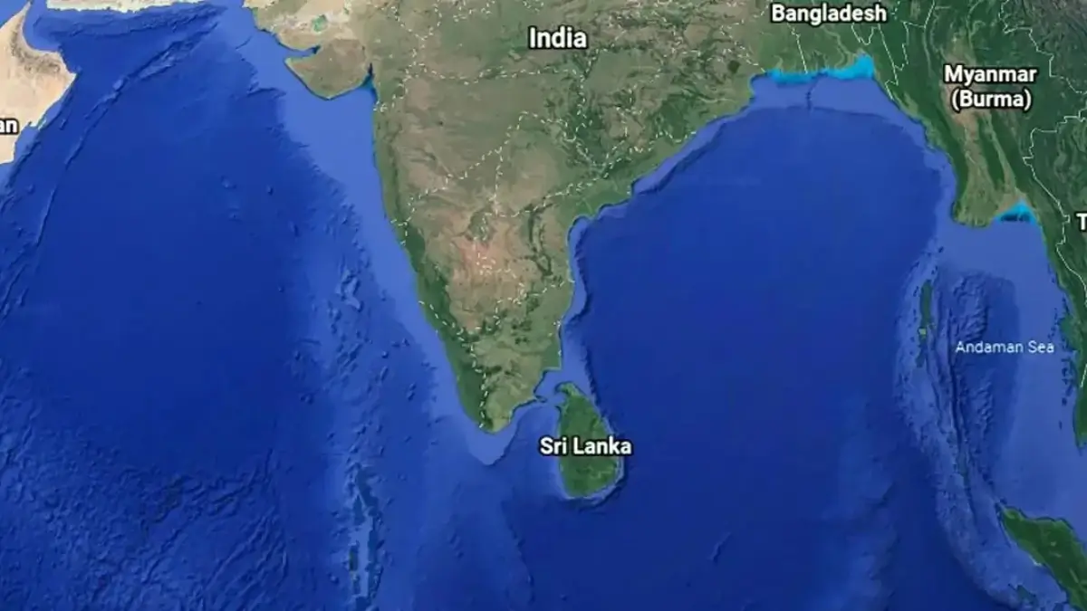
It lies very close to the southern tip of India, separated only by a narrow stretch of sea. Due to this closeness, the two nations share deep cultural, historical, and trade connections.
People, traditions, food habits, and even languages show many similarities between the two places. For centuries, travelers, traders, and rulers moved between them, strengthening their bond.
Because it appears like a drop falling from India on the world map, the country became popularly known as the “Tear Drop of India.”
Which Country is known as the Tear Drop of India?
Sri Lanka is known as the Tear Drop of India. Its outline looks like a water drop hanging beneath India, especially near Tamil Nadu. Because of this natural map-based similarity, the name became popular in geography books, general knowledge topics, and travel descriptions.
Check This: In which District of Uttar Pradesh the first Glass Museum of India is Located?
Why is Sri Lanka known as the Tear Drop of India?
- Drop-Like Shape on the Map: Sri Lanka has a rounded southern side and a slightly pointed northern side. From above, it clearly looks like a teardrop attached to India.
- Very Close to India: The two countries are separated by the Palk Strait, a narrow stretch of sea. At the closest point, the distance is only about 30 km, making them appear almost connected.
- Historical Land Link: Between India and Sri Lanka lies a chain of limestone shoals called Adam’s Bridge (Rama Setu). In ancient times, people believed it connected both lands.
Because of these features — shape, closeness, and natural connection — Sri Lanka got the nickname “Tear Drop of India.”
Geographic Location of Sri Lanka
Sri Lanka is an island country in South Asia located in the Indian Ocean. It lies southeast of India and southwest of the Bay of Bengal. Its position places it on important international sea routes between Asia, Europe, and the Middle East.
This strategic location made the country historically important for traders, travellers, and explorers.
Physical Features and Natural Landscape
Sri Lanka may be small in size, but its landscape is very diverse.
- Central Highlands: The middle of the country has mountains and hills. The highest peak is Pidurutalagala.
- Coastal Plains: Flat land surrounds the island, filled with beaches and coconut trees.
- Rivers and Waterfalls: Many rivers flow from the mountains to the sea, forming beautiful waterfalls.
- Forests and Wildlife: The island has tropical forests that support elephants, leopards, birds, and marine life.
Economic Importance of Sri Lanka
Sri Lanka’s economy depends on several important sectors:
- Agriculture: The country produces rice, coconut, rubber, and spices.
- Tea Production: Sri Lanka is world-famous for Ceylon Tea, one of its biggest exports.
- Tourism: Beautiful beaches, temples, wildlife parks, and heritage sites attract visitors from around the world.
- Trade and Shipping: Due to its position in the Indian Ocean, Sri Lanka plays a key role in international maritime trade routes.
Interesting Facts About the Tear Drop of India
- Pear-Shaped Island: Its shape is so clear that even children can easily identify it on a map.
- Close Distance from India: The shortest sea distance between India and Sri Lanka is only about 30 km.
- Ancient Cities: Historic cities like Anuradhapura and Polonnaruwa are UNESCO World Heritage Sites.
- Biodiversity Hotspot: Sri Lanka is home to elephants, leopards, whales, and rare plants.
- Strategic Location: Ships travelling between major continents pass near Sri Lanka, making it globally important.

 Where is the Strait of Hormuz Located?
 Best Airlines in the World 2026: Best Fu...
 Who Invented the QR Code? Check Here