
Did you know that some land areas almost look like islands but are still connected to the mainland? These are called peninsulas, and they are surrounded by water on most sides while staying attached to a continent.
They often have long coastlines, busy ports, and unique cultures shaped by the sea. Because water is nearby, trade, fishing, and travel grow faster in such regions.
Some peninsulas are small and easy to explore, but a few are so massive that they contain many countries, climates, and landscapes within them. From deserts to forests and snowy mountains, everything can exist in one huge stretch of land.
Geographers find them fascinating because they influence weather, history, and human settlement patterns. Civilizations have flourished on peninsulas for thousands of years due to access to both land and sea routes.
Today, one particular peninsula stands out on the world map for its unbelievable size and importance, making people curious about which one truly holds the record.
Which is the Largest Peninsula on Earth?
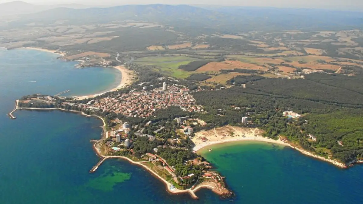
The Arabian Peninsula is the largest peninsula in the world. It covers roughly 3.2 million square kilometres, which makes it larger than many countries and even bigger than some geographic regions.
Due to its size, natural resources and location between continents, this peninsula has played a major role in world history, trade and global energy supply.
Why the Arabian Peninsula is considered as the Largest Peninsula?
A peninsula is defined as land surrounded by water on three sides and connected to land on one side. The Arabian Peninsula perfectly fits this definition.
It is bordered by:
- Red Sea — West
- Arabian Sea — South
- Persian Gulf — Northeast
- Gulf of Oman — East
The only land connection is in the north where it joins mainland Asia. Because no other peninsula covers such a huge area, it holds the title of the world’s largest peninsula.
Check This: Top-7 Countries with the Largest Uranium Reserves in 2026, Check the List
Geographic Location of Arabian Peninsula
The Arabian Peninsula lies in Southwest Asia. It acts as a natural bridge between Asia, Africa and Europe.
For thousands of years, travellers and traders passed through this region while moving goods between continents. Even today, many of the world’s busiest sea routes run close to its shores.
Countries Located on the Arabian Peninsula
Seven countries are located fully or mostly on the peninsula:
- Saudi Arabia (largest area)
- Yemen
- Oman
- United Arab Emirates (UAE)
- Qatar
- Kuwait
- Bahrain
Among these, Saudi Arabia occupies most of the central landmass.
Climate and Natural Features
The Arabian Peninsula has a hot desert climate. Rainfall is very low, and summers are extremely hot.
Major Physical Features:
1. Rub’ al Khali (Empty Quarter): One of the biggest continuous sand deserts in the world.
2. Mountain Ranges: Found mainly in western Saudi Arabia and Oman.
3. Plateaus and Rocky Areas: Large dry plains cover much of the interior.
4. Coastal Plains: Fertile strips near the seas where most cities developed.
Temperatures in some areas can go above 50°C, making it one of the hottest inhabited regions on Earth.
Interesting Facts About the Arabian Peninsula
- Largest Peninsula: Covers about 3.2 million sq km.
- Largest Sand Desert: Home to Rub’ al Khali, one of the harshest deserts on Earth.
- Energy Hub: Contains massive oil and gas reserves.
- Religious Centre: Origin of Islam and site of annual Hajj pilgrimage.
- Ancient Trade Crossroads: Connected Asia, Africa and Europe for centuries.
- Extreme Heat: Temperatures can exceed 50°C in summer.

 What is the Old Name of Punjab? Check He...
 GK Quiz on Strait of Hormuz, Questions a...
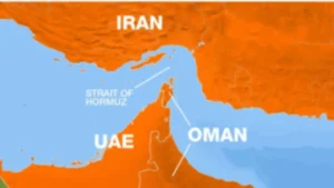 Which Countries Border the Strait of Hor...


