
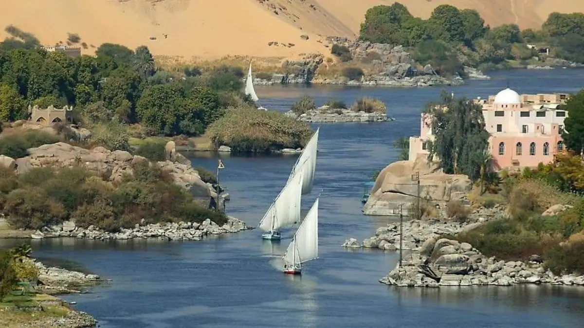
Did you know a single river made an entire civilization possible in Egypt? Long before modern cities existed, people settled along its banks because it gave them water, food, and fertile land in the middle of vast desert.
For thousands of years, farmers depended on its yearly floods. The water spread rich soil across the land, helping crops grow even where rain was almost absent. Because of this natural cycle, people never had to leave the region to search for food.
It also became a natural road. Boats carried traders, workers, and travelers from one town to another, connecting villages and building a strong economy. Temples and monuments were built close to its shores.
Even today, millions of people still rely on this river every day for drinking water, farming, and transport. Without it, the country would look completely different — mostly dry and empty land.
That is why historians call this river the true lifeline of the nation.
Which River is known as the Lifeline of Egypt?
The river known as the Lifeline of Egypt is the Nile River. Most of Egypt is desert, so people depend on this river for drinking water, farming, and daily life. Its yearly floods once left fertile soil that helped ancient civilisation grow. Even today, cities and farms are located along its banks. Without the Nile, Egypt would struggle to support its population and agriculture.
Why the Nile is known as the Lifeline of Egypt?
Egypt is mostly hot desert with very little rainfall. The Nile provides nearly everything needed for daily life:
- Drinking water for millions of people
- Irrigation for crops like wheat, rice, and cotton
- Transportation routes across the country
- Fish for food and income
- Electricity from dams
Without this river, large cities and agriculture would not exist in Egypt. That is why it earned the title “Lifeline of Egypt.”
Length and Unique Flow Direction
The Nile is about 6,650 kilometres long, making it the longest river in the world.
One unusual fact:
JMost rivers flow south, but the Nile flows from south to north into the Mediterranean Sea. This rare direction happens because the land slopes downward toward northern Egypt.
Check This: Which country is known as the Tea Garden of the World?
Sources of the Nile River
The river begins from two main branches:
White Nile
- Starts near Lake Victoria
- Provides steady water year-round
Blue Nile
- Begins at Lake Tana
- Carries fertile soil and minerals
These two rivers meet in Khartoum, forming the main Nile that continues toward Egypt.
Countries that Nile Passes Through
The Nile basin connects 11 African nations:
- Burundi, Rwanda, DR Congo, Tanzania, Kenya, Uganda, Ethiopia, Eritrea, South Sudan, Sudan, and Egypt.
- Because of this, the river is also important for international cooperation and water sharing.
The Fertile Gift of Flooding
Every year in ancient times, the Nile overflowed its banks. The floodwater left behind black silt rich in nutrients.
This soil turned dry desert into farmland and allowed Egyptians to grow crops regularly. Because of this blessing, the historian Herodotus called Egypt the “Gift of the Nile.”
Old Name of the ”Nile”
Ancient Egyptians called the river “Aur” or “Ar,” meaning black — referring to the dark soil it left behind.
They also named their land Kemet, meaning Black Land, because fertile soil existed only near the riverbanks.
The Queen of the Nile
The famous ruler Cleopatra depended heavily on the river. She used it for trade, travel, and meetings with Roman leaders. Her kingdom’s wealth came directly from Nile farming.
Significance of the Nile River
Today the river still supports Egypt:
- Supplies most freshwater
- Irrigates farmland
- Generates electricity through Aswan High Dam
- Supports fishing and tourism
Nearly 95% of Egyptians live near the river, proving its importance has not changed since ancient times.

 Who is known as the Father of Mobile Pho...
 Which is the Highest Airport in the Worl...
 Which Country is the Largest Exporter of...


