India is a land of diverse landscapes, and its administrative divisions reflect this geographical variety. The country is divided into districts, each with its own unique characteristics and significance. Here, we delve into the largest districts in India, measured by land area, to discover the vast expanses that contribute to the nation’s diversity.
Districts of India
The term “Indian districts” refers to the administrative units that intricately divide the states and union territories of India. Serving as essential components, these districts play a pivotal role in decentralized governance and focused development. They serve as a crucial link between state authorities and the grassroots, ensuring the effective implementation of policies and programs. At the helm of each district is a District Collector, or District Magistrate, acting as the principal executive officer overseeing comprehensive administration.
How Many Districts in India By January 2024?
As of 2024, India comprises a total of 806 districts, a number that has seen a gradual rise in response to the ongoing efforts to enhance administrative efficiency and promote development. These districts are distributed among 28 states and 8 union territories. The count of districts in India is subject to change, reflecting the dynamic nature of administrative adjustments. For instance, Madhya Pradesh is set to introduce three additional districts, elevating its total count from 52 to 55. This evolution underscores the nation’s commitment to refining governance structures for improved regional management.
India’s Largest District 2024
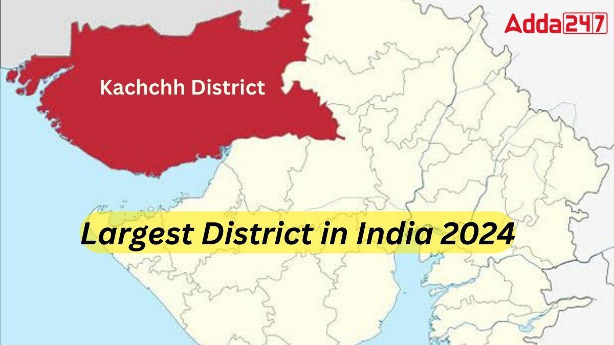
Gujarat’s Kachchh district stands as the largest district in India, covering a vast expanse of 45,674 square kilometers, which accounts for 23.27 percent of the entire geographical area of Gujarat. Bordered by Pakistan to the north and northwest, and Rajasthan to the north and east, Kachchh is characterized by extensive saline desert lands, with agriculture utilizing 34.73 percent of the total land area. The district is organized into ten Talukas, encompassing 939 villages and six municipalities. Renowned for its Kutchi populace, Kachchh also boasts a notable Indian onager population in the distinctive landscapes of the Rann of Kutch, Banni grasslands, and seasonal marshland wetlands in the Great and Little Rann.
Top-10 Biggest Districts in India
Kachchh district of Gujarat, with the area of 45674 square kilometers, is the biggest district in India, followed by Leh (Jammu and Kashmir), Jaisalmer (Rajasthan), and Bikaner (Rajasthan).
Here is the list of top-10 largest districts in India:
| LARGEST DISTRICTS IN INDIA | |||
| Rank | District | State | Area (in sq. km) |
| 1. | Kachchh | Gujarat | 45674 |
| 2. | Leh | Jammu and Kashmir | 45110 |
| 3. | Jaisalmer | Rajasthan | 38401 |
| 4. | Bikaner | Rajasthan | 30239 |
| 5. | Barmer | Rajasthan | 28387 |
| 6. | Jodhpur | Rajasthan | 22850 |
| 7. | Anantapur | Andhra Pradesh | 19130 |
| 8. | Mahbubnagar | Andhra Pradesh | 18432 |
| 9. | Nagaur | Rajasthan | 17718 |
| 10. | Kurnool | Andhra Pradesh | 17658 |
India’s Biggest District – Kachch
State: Gujarat
Area: 45674 square kilometers
Kutch district in Gujarat holds the title of India’s largest district, spanning 45,674 square kilometers. Renowned for the expansive salt deserts of the Rann of Kutch, it hosts the annual Rann Utsav, a vibrant celebration spotlighting the district’s natural splendor and rich culture. The administrative hub is the town of Bhuj.
Second Biggest District of India – Leh
State: Jammu and Kashmir
Area: 45110 square kilometers
Ladakh’s Leh district claims the position of India’s second-largest district, sprawling over 45,110 square kilometers. Known for its picturesque landscapes, Leh harbors popular tourist spots and trekking destinations. The district is renowned for the expansive Hemis National Park, the largest in India, and is predominantly inhabited by a Buddhist population communicating in the Bauti (Ladakhi) language.
Third Largest District in India – Jaisalmer
State: Rajasthan
Area: 38401 square kilometers
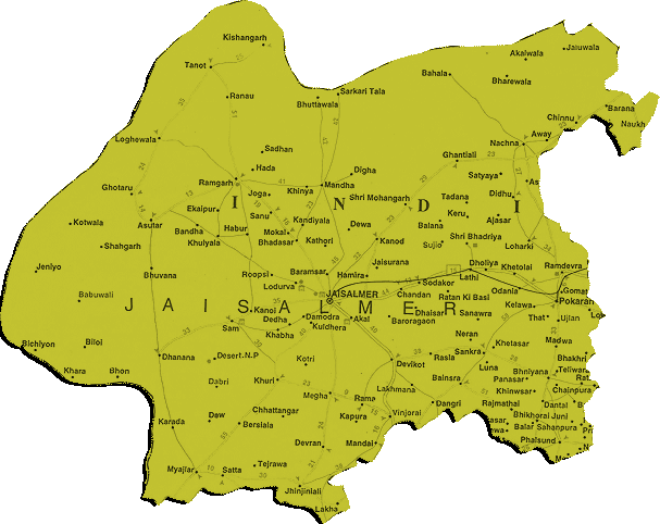
Situated in the expansive Thar desert, Jaisalmer claims the title of India’s third-largest district, covering 38,401 square kilometers. With a sparse population and a border adjacent to Pakistan, Jaisalmer holds the distinction of being the largest district in Rajasthan. The district’s headquarters, Jaisalmer city, renowned for the UNESCO world heritage site Jaisalmer Fort, is a popular destination in Rajasthan.


 Who is the Inventor of the Gramophone?
 What is the State Song of Andhra Pradesh...
 National Investigation Agency (NIA): Its...
