
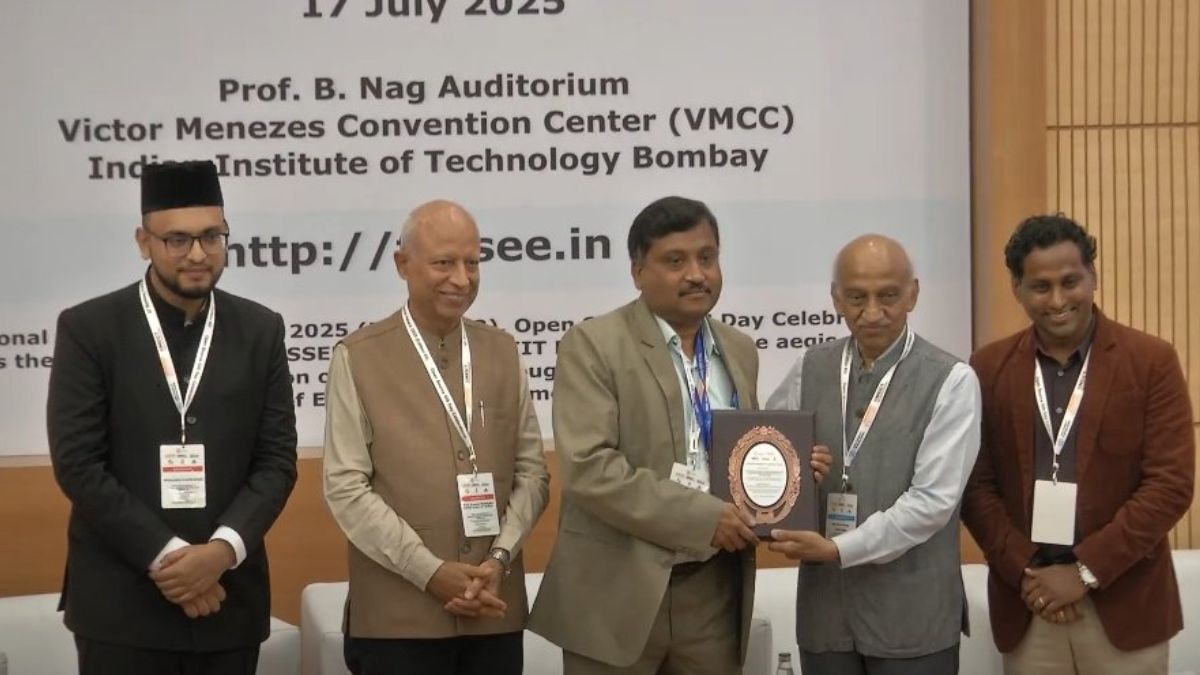
The Indian National Centre for Ocean Information Services (INCOIS) has been conferred the National Geospatial Practitioner Award 2025 for its exceptional application of open-source spatial technologies. The award was presented during the Open Source GIS Day (Edition 02) held at IIT Bombay, recognizing INCOIS’s contributions to marine geospatial intelligence and data-driven ocean management.
Background
INCOIS is an autonomous organization under the Ministry of Earth Sciences (MoES), headquartered in Hyderabad. It is responsible for providing ocean information and advisory services to various stakeholders, including fishermen, coastal authorities, disaster management agencies, and researchers. It plays a crucial role in India’s Ocean Observation and Forecasting System, supporting both national policy and operational preparedness.
Significance of the Award
The National Geospatial Practitioner Award is a prestigious recognition granted to institutions demonstrating innovative uses of geospatial technology. INCOIS’s use of open-source GIS (Geographic Information Systems) platforms has made oceanographic data more accessible, transparent, and adaptable for a wide range of applications. The award was handed to INCOIS Director T.M. Balakrishnan Nair by former ISRO Chairman A.S. Kiran Kumar, further highlighting its national value.
Objectives and Applications
- Promote cost-effective geospatial solutions through open-source tools
- Enhance real-time ocean data dissemination to end users
- Enable disaster warning systems for events such as tsunamis, storm surges, and oil spills
- Support marine ecosystem monitoring, fisheries advisory, and sustainable ocean management
- Strengthen spatial decision support systems using GIS-based mapping and forecasting models
Key Features of INCOIS’s GIS Initiatives
- Utilization of Open Source GIS platforms like QGIS and GeoServer
- Dynamic satellite-based real-time ocean graphic services
- Public-facing web applications providing Marine Weather Advisories, Potential Fishing Zones (PFZ), and Tsunami Bulletins
- Integration with remote sensing, IoT-enabled buoys, and ocean modeling systems

 International Booker Prize 2026 Shortlis...
 19-Year-Old Sheetal Devi Honoured as Wor...
 Ramnath Goenka Awards 2026 Winners List:...


