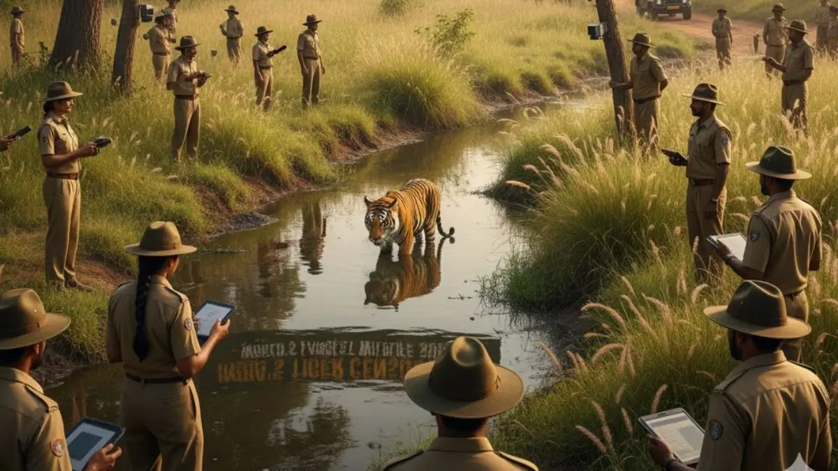
India is preparing for the 2026 All India Tiger Estimation (AITE) — the world’s largest and most sophisticated wildlife survey. With India home to over 75% of the global wild tiger population, the AITE goes far beyond tiger counts. It evaluates the health of entire ecosystems, covering prey density, forest quality, habitat pressure, and human-wildlife interaction zones. Building upon the 2022 survey that recorded 3,682 tigers, the upcoming census aims to deploy cutting-edge technology alongside traditional fieldwork, setting a global benchmark for conservation science.
Phase 1: On-Ground Tracking and Habitat Mapping
The first phase starts with forest guards patrolling designated transects across reserves and forest divisions,
- Each guard walks around 15 km over three days.
- They record indirect signs of tigers: pugmarks, claw marks, scat, and prey remains.
- Observations also include prey sightings (like deer and sambar) to assess food availability.
- Vegetation density (trees, shrubs, grasses) and signs of human presence (wood cutting, cattle dung) are also tracked to gauge habitat health and pressure.
- This phase provides vital ground truthing data that forms the base layer for satellite-assisted analysis.
Phase 2: Satellite Integration and Remote Sensing
Once field data is collected, the Wildlife Institute of India (WII) in Dehradun steps in with satellite imaging and data analytics,
- Remote sensing is used to study forest cover, terrain, water sources, and human encroachment.
- It helps identify critical habitats, wildlife corridors, and stress zones.
- This satellite-aided mapping guides camera placement in the next phase by pinpointing areas of high tiger activity likelihood.
- The fusion of on-ground and satellite data ensures scientific precision and resource optimisation.
Phase 3: Camera Traps and AI-Based Identification
The third and most high-profile phase involves deploying over 40,000 camera traps across a grid-based system,
- Each 4 sq km grid contains two motion-sensitive cameras.
- Cameras are placed near trails, ridgelines, or waterholes identified during ground surveys.
- Cameras remain active for 25 days, capturing images of wildlife movements.
- Images are analysed using software that recognises unique stripe patterns, identifying each tiger individually.
In 2022, Karnataka alone identified 563 tigers through this method, showcasing the effectiveness of this AI-driven approach.
Static GK Facts
- Survey Name: All India Tiger Estimation (AITE)
- Next Census Year: 2026
- Previous Count (2022): 3,682 tigers
- Coverage Area: Over 400,000 sq km across 20+ states
- Personnel Involved: More than 60,000 forest staff

 WHO Foundation and Novo Nordisk Launch I...
 NITI Aayog Releases Fiscal Health Index ...
 UIDAI Launches Bug Bounty Program to Str...