
A dedicated team of international geologists and seismologists has embarked on a mission to chart the depths of Zealandia, a relatively unknown landmass submerged beneath the Pacific Ocean. Their efforts have resulted in the creation of an updated and highly detailed map that sheds light on the continent’s intriguing geological features.
Where in the World is Zealandia?
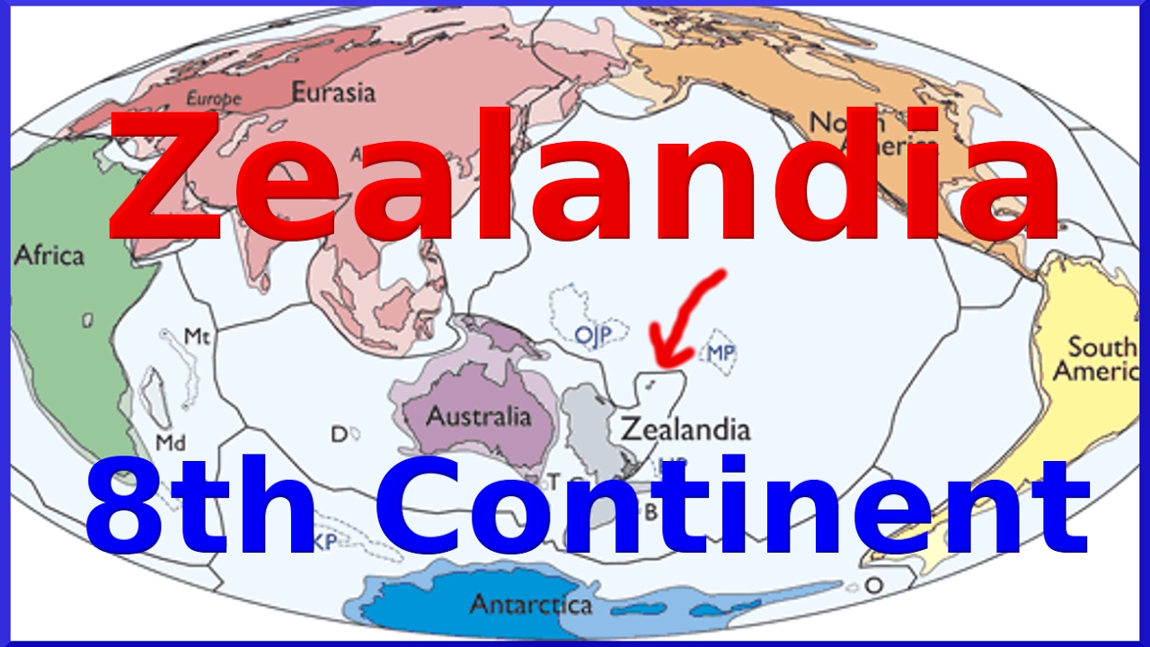
Zealandia, often referred to as the eighth continent, remains shrouded in oceanic mystery, with a staggering 94% of its expanse concealed beneath the sea’s surface. The remaining 6% peeks above the waves, encompassing islands such as New Zealand and its neighboring isles.
The geological history of Zealandia dates back approximately 83 million years when volcanic forces played a pivotal role in the separation of the supercontinent Gondwana, giving rise to the continents we recognize today.

Unveiling the Cartographic Marvel
Creating the refined map of Zealandia was no small feat. The research team embarked on a comprehensive journey, utilizing an array of methodologies to illuminate this submerged realm. Here’s how they did it:
1. Oceanic Rock Samples and Sediments
To refine the existing maps, the scientists meticulously examined rock samples and sediment specimens collected from the ocean floor. These valuable materials were acquired through drilling operations and coastal expeditions within the region.
2. Seismic Data Analysis
The research journey extended beyond rock samples. The team delved into seismic data gathered from the Zealandia area, further enhancing their understanding of its geological makeup.
3. Mapping the Entire Continent
With these essential resources at their disposal, the scientists embarked on the monumental task of mapping Zealandia in unprecedented detail. This submerged continent spans a vast 5 million square kilometers.
Unlocking Geological Secrets
The examination of the samples uncovered intriguing geological patterns in Western Antarctica, hinting at the presence of a potential subduction zone near Campbell Plateau on New Zealand’s western coast. Despite this revelation, magnetic anomalies in the region did not disprove theories of a strike-slip along the Campbell Fault.
The scientists proposed that the Campbell Magnetic Anomaly System originated from the stretching of Gondwana as it underwent a process of fragmentation. This stretching ultimately led to a significant rupture, resulting in the creation of the ocean floor that now constitutes the lower portions of Zealandia.
![]()


 72nd National Film Awards 2026: Who Won ...
 Andy Burnham Confirmed as UK Labour Lead...
 Gujarat Tops NITI Aayog's First Investme...

