
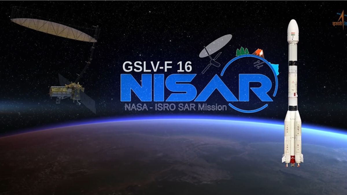
India is set to launch the NASA-ISRO Synthetic Aperture Radar (NISAR) satellite—the first collaborative Earth observation mission between ISRO and NASA on July 30, 2025, using the GSLV-F16 rocket from the Satish Dhawan Space Centre (SDSC-SHAR), Sriharikota. The satellite will be placed in a Sun-synchronous orbit (SSO) at an altitude of 743 km with an inclination of 98.4°, enabling consistent observation of Earth’s surface in all weather and lighting conditions.
Background
The NISAR mission is the result of over a decade of technical collaboration between ISRO and NASA’s Jet Propulsion Laboratory (JPL). It integrates NASA’s L-band radar and ISRO’s S-band radar on a single satellite platform. The use of NASA’s 12-meter unfurlable mesh reflector antenna, attached to ISRO’s modified I3K satellite bus, demonstrates significant technological synergy between the two space agencies.
Significance
NISAR is a landmark in international space cooperation and a major step forward for global Earth observation capabilities. It is the first satellite to use dual-frequency Synthetic Aperture Radar (SAR) for civilian use. With its ability to monitor surface changes as small as a centimeter, it is expected to revolutionize the way scientists understand climate, ecosystems, and natural disasters.
Objectives
The main goal of the NISAR mission is to provide high-resolution, all-weather, day-and-night data on Earth’s surface every 12 days. It will help monitor natural hazards, track agricultural trends, assess disaster impacts, and study ecosystem disturbances. Specific scientific objectives include tracking glacier movements, ground deformations, land subsidence, and changes in vegetation and soil moisture.
Key Features
- Launch Vehicle: ISRO’s GSLV-F16
- Launch Date: July 30, 2025, at 17:40 IST
- Satellite Mass: 2392 kg
- Orbit Type: Sun-Synchronous Orbit at 743 km altitude
- Radar Bands: L-band (NASA) and S-band (ISRO)
- Swath Width: 242 km
- Technology Used: SweepSAR technique
- Revisit Time: 12-day global coverage cycle
Applications and Impact
NISAR’s data will benefit multiple sectors,
- Disaster Management: Landslides, earthquakes, and flood mapping
- Climate Research: Polar ice monitoring and storm tracking
- Agriculture: Soil moisture analysis and crop monitoring
- Urban Planning: Surface deformation and infrastructure stability
- Environmental Monitoring: Forest cover change and water body dynamics
- Its all-weather capability will also assist governments and researchers in policy-making, resource management, and climate resilience strategies.

 UAE Introduces World's First 10G Interne...
 Meet MAI-Transcribe-1: Microsoft’s Fast,...
 What is Outer Space Treaty 1967? Princip...


