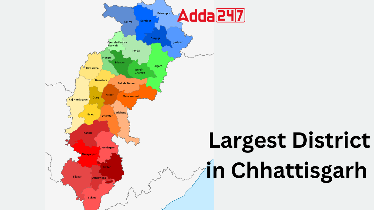
Chhattisgarh, known for its rich cultural heritage and diverse landscapes, is home to several districts, each with its own unique identity and significance. Among them, Surguja stands out as the largest district in terms of area and offers a captivating blend of natural beauty, tribal culture, and historical richness.
How many Districts are there in Chhattisgarh?
Chhattisgarh encompasses a total of 33 districts, spanning across a combined area of 135,192 square kilometers. Initially comprising only 16 districts, the state witnessed subsequent expansions, resulting in the creation of additional districts over the years. Notably, the most recent addition to Chhattisgarh’s district map is Khairagarh-Chhuikhadan-Gandai, established in 2022, marking a continuous evolution in the state’s administrative landscape.
Largest District in Chhattisgarh in terms of Area
Surguja district stands as the largest district in Chhattisgarh in terms of area, spanning 5,732 square kilometers. Nestled in the eastern part of the Vindhyachal-Baghelkhand region, its headquarters in Ambikapur marks its significance. The district, rich in diversity, encompasses sprawling mountainous terrains and is home to various ethnic communities, including the Gond.
Key Facts Related to Biggest District in Chhattisgarh
Here are some key facts related to Surguja, the largest district in Chhattisgarh:
- Surguja district is the largest district in Chhattisgarh, with Ambikapur as its headquarters.
- It is one of the oldest districts in the state, rich in historical significance and cultural heritage.
- Surguja is situated to the east of the Vindhyachal-Baghelkhand region and encompasses the Surguja dialectal area.
- The district spans over 5,732 square kilometers of mountainous terrain and is inhabited by diverse ethnic groups including the Gond, Bhumij, Oraon, and others.
- Surguja has a rich history dating back to ancient times, with legends suggesting connections to the epic of Ramayana.
- The region was ruled by various dynasties including the Mauryas, Nandas, Rajputs, Marathas, and later came under British rule.
- Surguja became part of Madhya Pradesh in 1951 and later became a district in the newly formed state of Chhattisgarh in 2000.
- The district is divided into seven tehsils and is well-connected by rail, road, and air transport.
- Agriculture is a primary occupation, with about 90% of the population depending on it, and the district is known for its fertile plains and mineral reserves.
- As of the 2011 census, Surguja district has a population of 2,359,886, with Surgujia being the dominant language spoken by 65.07% of the population.
Largest District of Chhattisgarh in terms of Population
Raipur emerges as the most populous district in Chhattisgarh, boasting an estimated population of 2,160,876 individuals according to the 2011 census. As the largest district in terms of population, Raipur serves as a bustling center of activity and urban development within the state, playing a pivotal role in Chhattisgarh’s demographic landscape.
Name of Districts of Chhattisgarh, List
Chhattisgarh encompasses a total of 33 districts, spanning across a combined area of 135,192 square kilometers. Here is the complete list of districts of Chhattisgarh:
| Name of Districts of Chhattisgarh | ||
| Sakti | Dhamtari | Raipur |
| Durg | Baloda Bazar | Kondagaon |
| Sukma | Raigarh | Kabirdham |
| Gariaband | Surajpur | Bijapur |
| Bemetara | Kanker | Sarangarh-Bilaigarh |
| Khairagarh-Chhuikhadan-Gandai | Bilaspur | Rajnandgaon |
| Chowki | Dantewada | Balrampur |
| Balod | Mahasamund | Gaurella-Pendra-Marwahi |
| Jashpur | Janjgir-Champa | Koriya |
| Manendragarh-Chirmiri-Bharatpur | Bastar | Narayanpur |
| Surguja | Mohla-Manpur | Mungeli |


 Which Lake is known as the Jewel of Udai...
 Which is the Largest Banana Producing St...
 Which is the First Tiger Reserve of Utta...


