
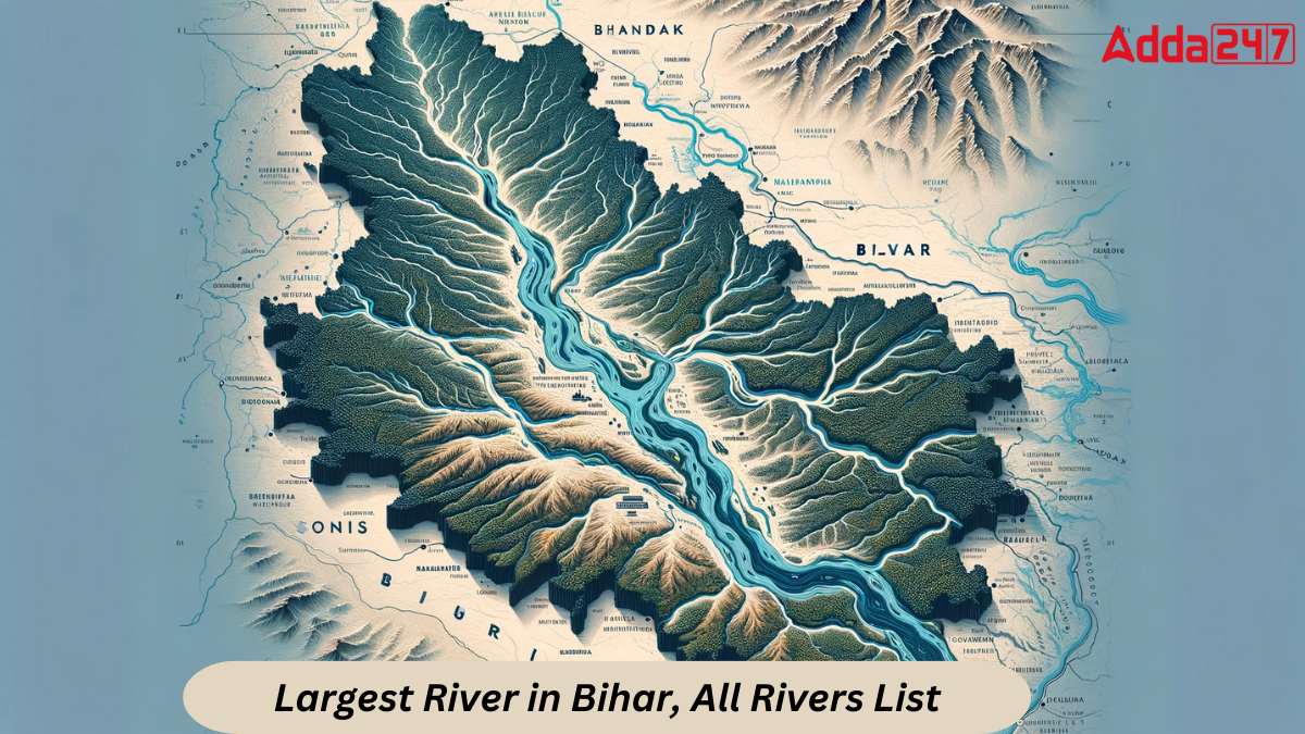
Bihar, often referred to as the “Land of Rivers,” boasts a robust agricultural economy intertwined with the lifelines of its rivers. The state’s geography is divided by the mighty Ganga, creating two distinct regions – Northern and Southern Plains. In this article, we explore the largest rivers in Bihar, their characteristics and the pivotal role they play in shaping the state’s economy.
First Understand the concept of Northern and Southern Bihar Rivers with their characteristics:
Northern Bihar Rivers
The Northern Plains, situated north of the Ganga, host a network of seasonal and perennial rivers originating in the Himalayas. These rivers, including Burhi Gandak, Gandak, Mahananda, Kosi and Ghaghra, contribute significantly to the agricultural landscape. Originating in Tibet and Nepal, these rivers bring both blessings and challenges to the region.
Features of Northern Bihar Rivers:
- Himalayan Origin: The rivers in northern Bihar find their source in the majestic Himalayas, flowing through the diverse landscape of Tibet and Nepal.
- Monsoon Impact: During the monsoon season, these rivers witness a substantial increase in precipitation, creating dynamic conditions for agriculture.
- Ox-box Lakes Formation: Shifting courses of these rivers result in the formation of Ox-bow lakes, adding to the geographical diversity of the region.
- Siltation and Steep Slopes: High siltation and steep slopes in the upper reaches of these rivers make them prone to disasters, emphasizing the need for sustainable management.
Southern Bihar Rivers
The Southern Plains, drained by rivers like Kiul, Sone, Badua Chandan and Karmnasa, present a different topography. Originating from Vindhyachal hills or Chhotanagpur and Rajmahal Hills, these rivers face challenges such as obstacles from the southern bank of the Ganga and the formation of low-lying areas called Tal.
Feature of Southern Bihar Rivers:
- Diverse Origin: Rivers in southern Bihar originate from Vindhyachal hills, Chhotanagpur or Rajmahal Hills, showcasing the diverse geography of the region.
- Obstacles to Drainage: The southern bank of the Ganga poses obstacles to land drainage, impacting the overall topography.
- Formation of Tals: Low-lying areas, known as Tals, are formed due to the meandering courses of various rivers, creating distinctive land formations.
Largest River in Bihar
The Ganges, the largest river in Bihar, enters the state through Chausa, serving as the boundary between Saran and Bhojpur Districts. Its origin lies in the Western Range of the Himalayas. This mighty river, along with is tributaries, serves as a perpetual water source of Bihar’s agricultural heartland.
Dividing the state into two unequal parts, the Ganges play a crucial role in sustaining the agrarian landscape. Noteworthy tributaries such as Kosi, Kali, Bagmati and Gandak contribute to the Ganges’ immense flow. On the left bank, rivers like Ghaghra, Damodar, Kosi, Mahakali and Karnali add to its might, while on the right bank, Chambal, Mahananda, Son and Yamuna further enrich its waters.
An iconic symbol of connectivity, the Mahatma Gandhi Setu, a part of National Highway 19, spans the Ganges, linking North Bihar to the southern region. This monumental bridge stands as a testament to the significant of the Ganges in shaping Bihar’s geography and fostering unity across its diverse landscape.
List of Major Rivers in Bihar
Here is the complete list of the Rivers of Bihar along with their length and area of catchment and other important details:
| List of Rivers in Bihar | |||||
| S. No. | Name of Basin | Name of River | Total Catchment Area (sq. km) | Catchment Area in Bihar (sq. km) | Length of Main River in Bihar (km) |
| 1. | Main Ganga Stem | Ganga River | 136970 | 16205 | 445 |
| 2. | Ghaghra | Ghaghra River | 127950 | 2995 | 83 |
| 3. | Gandak | Gandak River | 40553 | 4188 | 260 |
| 4. | Burhi Gandak | Burhi Gandak | 12021 | 9601 | 320 |
| 5. | Bagmati-Adhwara | Bagmati | 14384 | 6500 | 394 |
| 6. | Kamla-Balan | Kamla | 7232 | 4488 | 120 |
| 7. | Mahananda | Mahananda | 23700 | 6150 | 376 |
| 8. | Son | Son | 70228 | 1483 | 202 |
| 9. | Kosi | Kosi | 74030 | 11410 | 260 |
| 10. | Punpun | Punpun | 9026 | 7536 | 235 |
| 11. | Kiul-Harohar | Kiul | 17225 | 12806 | 41 |
| 12. | Badua | Badua | 2215 | 2215 | 130 |
| 13. | Chandan | Chandan | 4093 | 2371 | 118 |
| 14. | Karmanasa | Karmanasa | 7792 | 5127 | 24 |
Bihar’s Largest River – Ganga River
Total Catchment Area: 136970 sq. km
Catchment Area in Bihar: 16205 sq. km
Length of Main River in Bihar: 445 km
Tributaries of Ganga: Ghaghra, Gandak, Burhi-Gandak, Kosi, Mahananda
Ganga, the primary river in Bihar, makes its entry into the state at Chausa, marking the boundary between Bhojpur and Saran districts.
The construction of the Mahatma Gandhi Setu, integrated into National Highway 19 (NH19), serves as a vital link, connecting North Bihar seamlessly with the remainder of the state. This monumental bridge plays a crucial role in facilitating transportation and connectivity across different regions of Bihar.
Second Largest River in Bihar – Ghaghra River
Total Catchment Area: 127950 sq. km
Catchment Area in Bihar: 2995 sq. km
Length of Main River in Bihar: 83 km
Tributaries: Little Gandaki, Sondhi Nala and Daha
The Ghaghra River, a transboundary perennial watercourse, originates in Tibet near Mansarovar Lake.
Flowing into the state of Bihar at Gopalganj, the Ghaghra eventually merges with the Ganga at Chhapra, becoming one of its significant left Tributaries.
Ranked as the second-largest tributary after the Yamuna, the Ghaghra holds cultural and spiritual significance for both the Buddhist and Hindu communities.
Noteworthy irrigation projects, namely the SaryuNahar Irrigation Project and SardaShayak Irrigation Scheme, harness the waters of the Ghaghra to support agricultural activities and development in the region.
Third Largest River in Bihar – Gandak River
Total Catchment Area: 40553 sq. km
Catchment Area in Bihar: 4188 sq. km
Length of Main River in Bihar: 260 km
Tributaries: Bhabsa, Harha
The Gandak River begins its journey in North Dhaulagiri, Tibet and crosses into Indian territory through Triveni, Nepal.
This river serves as the natural border between Uttar Pradesh and Bihar, defining the geographical boundary between the two states.
Eventually, the Gandak River merges with the Ganga River at Sonepur, situated near the city of Patna.
Find More General Studies News Here


 How an Italian Sculptor Created the FIFA...
 Which District of Uttar Pradesh Shares B...
 World’s First 7-Star Luxury Train: Rou...

