
In a recent heartbreaking incident, at least seven members of a family, including minors, are feared to have drowned in the Narmada River in Gujarat’s Narmada district. This tragic event brings focus to one of India’s major rivers, the Narmada, highlighting both its geographical importance and the dangers it poses.
An Overview of Narmada River
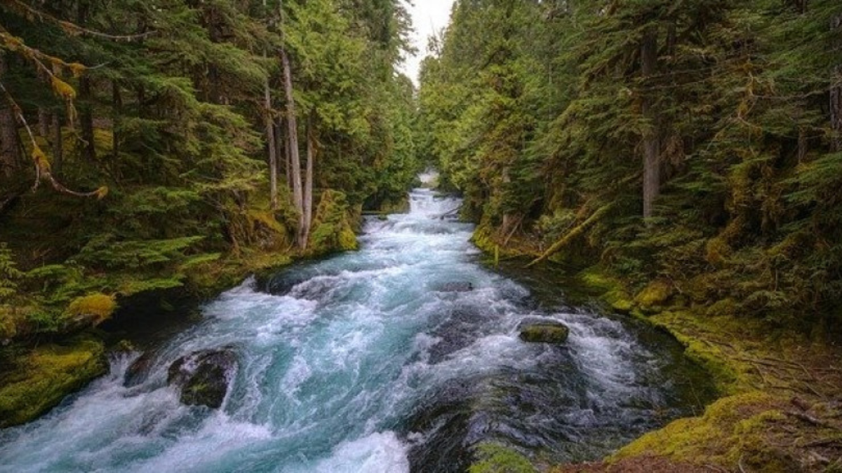
The Narmada River, also known as the largest west-flowing river in peninsular India, is a significant waterway that plays a crucial role in the regions it traverses. It is notable for being one of the few major rivers in India that flows from east to west.
Origin and Course of the Narmada River
The Narmada River originates from a small reservoir named Narmada Kund, located on the Amarkantak Hill in East Madhya Pradesh at an elevation of 1,057 meters (3,467.8 feet). From its source, the river travels a total length of 1,312 kilometers (815 miles), making it the fifth longest river in India. The river flows through the states of Madhya Pradesh, Maharashtra, and Gujarat, nestled between the Vindhya and Satpura hill ranges, before it empties into the Gulf of Cambay in the Arabian Sea, about 10 kilometers north of Bharuch, Gujarat.
Total Length of the Narmada River
The Narmada River spans a total length of 1,312 kilometers (815 miles) from its source at Narmada Kund in Amarkantak Hill, Madhya Pradesh, to its mouth in the Arabian Sea near Bharuch, Gujarat. As the fifth longest river in India, it traverses through Madhya Pradesh, Maharashtra, and Gujarat, playing a crucial role in the water supply and agriculture of these regions.
Tributaries of the Narmada River
The Narmada River is fed by several tributaries, classified based on their point of entry into the main river:
Right-Bank Tributaries: Hiran, Tendori, Barna, Kolar, Man, Uri, Hatni, and Orsang.
Left-Bank Tributaries: Burner, Banjar, Sher, Shakkar, Dudhi, Tawa, Ganjal, Chhota Tawa, Kundi, Goi, and Karjan.
Geographical Significance of the Narmada River
The Narmada basin covers an area of 98,796 square kilometers, which constitutes nearly 3% of the total geographical area of India. The basin is geographically bound by the Vindhya range to the north, the Maikala range to the east, the Satpura range to the south, and the Arabian Sea to the west. Interestingly, the Tropic of Cancer crosses the Narmada basin in its upper plains area, with a significant portion of the basin lying just below this line.


 Who is known as the Father of Mobile Pho...
 Which is the Highest Airport in the Worl...
 Which Country is the Largest Exporter of...


