The Periyar River, the longest river in Kerala, is often referred to as the “Lifeline of Kerala” due to its significant economic contribution to the state. It spans a length of 244 kilometers and drains an area of 5,398 square kilometers.
Longest River of Kerala
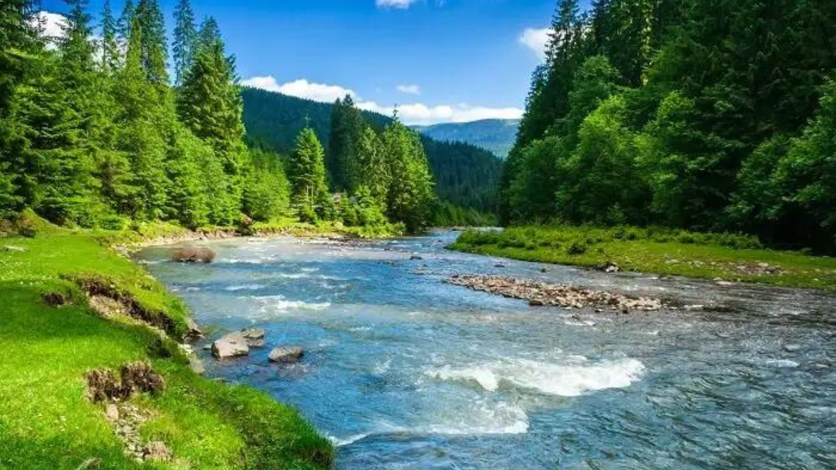
Periyar is the longest river in Kerala, stretching 244 kilometers. It boasts the largest discharge capacity among rivers in the state and is one of the few perennial rivers in the region. Periyar supplies drinking water to several major cities and plays a vital role in the state’s industrial and commercial activities. Additionally, it generates a significant portion of Kerala’s electricity via the Idukki Dam. This river is often referred to as the “Lifeline of Kerala.”
Origin of the Periyar River
Periyar originates in the Sivagiri hills of the Western Ghats, starting from the southeastern boundary of Idukki district. The river’s source is located in the distant forests of the Periyar Tiger Reserve, specifically from Chokkampatti Mala, a peak on the reserve’s southern border. While some non-governmental sources suggest its origin in the Sivagiri peaks of Sundaramala, Tamil Nadu, the Supreme Court of India ruled in 2014 that Tamil Nadu cannot claim to be the original state of the Periyar River. Below the river’s origin lies a 350 square kilometer jungle, with its highest reaches remaining untouched and inaccessible.
Length of the Periyar River
The Periyar River, the longest river in Kerala, stretches for 244 kilometers. Originating in the Western Ghats of Tamil Nadu, it flows through Periyar National Park and into Periyar Lake, eventually reaching the Arabian Sea. Known as the “Lifeline of Kerala,” it significantly contributes to the state’s economy and supports various activities, including irrigation and hydroelectric power generation.
Tributaries of the Periyar River
The Periyar River is nourished by several key tributaries, including:
- Muthirapuzha
- Mullayar
- Cheruthoni
- Perinjankutti
These tributaries boost the river’s ability to meet the varied demands of the regions it flows through, increasing its overall flow and water volume.
Basin of Periyar River
The Periyar basin covers a total area of 5,398 square kilometers, primarily in central Kerala. It spans the districts of Idukki, Ernakulam, and Thrissur in Kerala, as well as the Coimbatore district in Tamil Nadu. Shaped like an inverted “L,” the basin features a length-to-width ratio of 6:1. The streams in this basin flow through deep gorges with steep slopes in the highlands. After emerging from the hills, the Periyar River flows westward, encompassing
Dams of Periyar River
The Idukki Dam, constructed on the Periyar, is the largest dam and hydroelectric project in Kerala and one of the highest arch dams in Asia. Other significant dams across the river include Neriyamangalam, Pallivasal, Panniyar, Kundalam, Chenkulam, and Mullaperiyar.
Map of Periyar River
From its source, Periyar flows north from the Western Ghats, merging with the westward-flowing Mullayar River in Mullakudy. The river runs through various parts of the Periyar Tiger Reserve, forming borders between different sections of the reserve. It eventually empties into Periyar Lake, which is an artificial reservoir created by a dam at the confluence of the Periyar and Mullayar rivers. Some water from Periyar is diverted into the Nirar River, a Tamil Nadu tributary, and redirected through a tunnel to meet the Suruliar River, a tributary of the Vaigai River.
Economic Importance of the Periyar River
The Periyar River, often called the “Lifeline of Kerala,” is vital to the state’s economy. It supports irrigation, providing water for agriculture, and houses significant hydroelectric projects, including the Idukki Dam, which supplies power to the region. The river also plays a crucial role in supplying drinking water and sustaining local industries, contributing to Kerala’s overall economic stability.


 What is National Investigation Agency? C...
 Which State is the Largest Petroleum Pro...
 Largest Crude Oil Supplier Countries to ...