
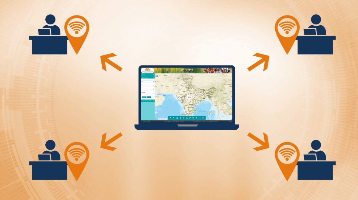
To empower Gram Panchayats and improve grassroots spatial planning, the Ministry of Panchayati Raj launched tools like the GIS app “Gram Manchitra” and mobile solution “mActionSoft.” Utilizing geo-spatial technology, these tools offer a unified platform for visualizing and planning developmental works, facilitating the formulation of the Gram Panchayat Development Plan (GPDP).
Gram Manchitra: A Geo-Spatial Platform for Developmental Planning
1.Unified Geo-Spatial Platform
- The Gram Manchitra application serves as a single and unified Geo-Spatial platform. This platform is instrumental in facilitating decision-making processes related to the GPDP.
- It empowers Gram Panchayats to visualize developmental works across diverse sectors in a comprehensive manner.
2.Visualizing Developmental Works
- One of the primary functions of Gram Manchitra is to enable Gram Panchayats to better visualize developmental projects.
- Through geo-spatial technology, officials can gain insights into various works planned at the Gram Panchayat level, fostering a more transparent and informed approach to spatial planning.
3.Decision Support System
- Gram Manchitra goes beyond visualization by providing a robust decision support system. It equips Gram Panchayat officials with planning tools that utilize GIS technology.
- These tools aid in the identification of potential project sites, asset tracking, project cost estimation, and impact assessment, ensuring the development plans are realistic and achievable.
mActionSoft: Transforming Asset Management Through Geo-Tagging
1.Mobile-Based Asset Capture
- Complementing Gram Manchitra, the Ministry has introduced mActionSoft, a mobile-based solution designed to capture photos with Geo-Tags (GPS Coordinates) for projects producing assets.
- This mobile application simplifies the process of recording vital information at three key stages: before the commencement of work, during the work, and upon completion.
2.Comprehensive Geo-Tagging
- mActionSoft ensures comprehensive geo-tagging of assets related to natural resource management, water harvesting, sanitation, agriculture, check dams, and irrigation channels.
- The geo-tagged assets contribute to a detailed repository of information, enhancing the overall visibility and understanding of developmental works within Gram Panchayats.
3.Integration with Gram Manchitra
- Assets geo-tagged using mActionSoft seamlessly integrate with Gram Manchitra. This integration enhances the visualization of various developmental works on the Gram Manchitra platform, providing a holistic view of the initiatives undertaken by Gram Panchayats.
Streamlining Planning, Enhancing Transparency, and Fostering Informed Decision-Making
- Empowered with GIS technology, these tools not only streamline the planning process but also foster transparency, accountability, and informed decision-making.
- The integration of mobile-based geo-tagging further strengthens the data repository, ensuring a comprehensive understanding of the developmental landscape.
Important Questions Related to Exams
Q. What is the purpose of the Geographic Information System (GIS) application “Gram Manchitra” introduced by the Ministry of Panchayati Raj?
Answer: Gram Manchitra aims to empower Gram Panchayats and enhance spatial planning efficiency at the grassroots level.
Q. How does Gram Manchitra serve as a unified Geo-Spatial platform for Gram Panchayats?
Answer: Gram Manchitra provides a single platform for Gram Panchayats to visualize developmental works and aids in decision-making related to the Gram Panchayat Development Plan (GPDP).
Q. What is the purpose of the mobile-based solution “mActionSoft” introduced by the Ministry?
Answer: mActionSoft is designed for mobile-based asset capture, capturing photos with Geo-Tags for projects producing assets.
![]()


 Gujarat Tops NITI Aayog's First Investme...
 PM Modi Inaugurates Advanced Mother and ...
 Government to Introduce Bill Making Insu...

