
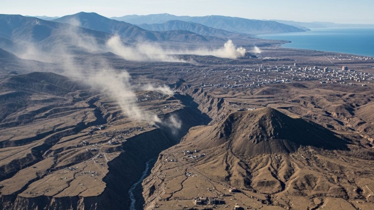
A series of powerful earthquakes recently struck Russia’s Kamchatka Peninsula, with the most intense tremor recorded at 7.4 magnitude. The epicentre was located offshore, 144 km east of Petropavlovsk-Kamchatsky, at a shallow depth of 20 km. Although an initial tsunami warning was issued, it was later withdrawn by the Pacific Tsunami Warning Centre.
Background
The Kamchatka Peninsula is situated in far eastern Russia, bordered by the Sea of Okhotsk to the west and the Pacific Ocean and Bering Sea to the east. The region lies at the convergence of the Pacific and North American tectonic plates, making it prone to frequent and intense seismic and volcanic activity. This area is a key part of the Pacific Ring of Fire, known for its geological instability.
Key Features
- The strongest quake measured 7.4 magnitude, with four others also registering significant strength.
- The tremors originated offshore at a depth of 20 km, increasing the likelihood of potential tsunami waves.
- The region contains two main mountain ranges: the Sredinny (Central) Range and the Vostochny (Eastern) Range.
- Kamchatka is also home to the Volcanoes of Kamchatka, designated as a UNESCO World Heritage Site.
Impact
Despite the strength of the quakes, there was no major tsunami threat reported after initial concern. However, such seismic events pose risks to local infrastructure, marine ecology, and volcanic reactivation. The quakes highlight the vulnerability of tectonically active regions like Kamchatka and raise the importance of disaster preparedness.
Significance
The seismic activity reaffirms Kamchatka’s status as a high-risk zone on the global seismic map. Events like these help geoscientists study plate tectonics, subduction zones, and earthquake forecasting. It also underscores the need for early warning systems in coastal and tectonically active regions.

 Preeti Saran Re-Elected as UN Committee ...
 Global Trade Hits New High in 2025: Key ...
 Iran–US Ceasefire: Iran’s 10 Conditions ...


