
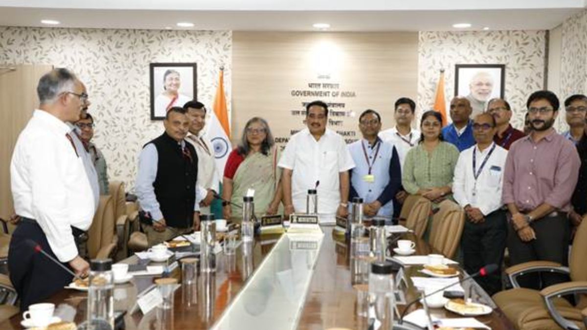
In a major step towards modernising India’s disaster response mechanism, Union Minister of Jal Shakti, Shri C. R. Patil, inaugurated C-FLOOD, a Unified Inundation Forecasting System, on July 2, 2025. Developed collaboratively by C-DAC, CWC, and NRSC, this web-based platform provides two-day advance flood forecasts at the village level, aimed at enhancing preparedness and mitigating flood risks in vulnerable regions. The project is part of the National Supercomputing Mission (NSM), showcasing India’s synergy of science and technology in tackling climate challenges.
Why in News?
The C-FLOOD platform was officially launched by Union Minister Shri C.R. Patil in New Delhi on July 2, 2025. Its launch marks a significant technological advancement in India’s flood forecasting capabilities, enabling early warnings and real-time inundation mapping. This tool is expected to support national and state disaster management authorities in planning timely evacuations and reducing flood-induced losses.
Objectives and Features of C-FLOOD
- Offers two-day advance flood forecasts up to the village level.
- Disseminates forecasts through flood inundation maps and water level predictions.
- Acts as a unified platform integrating flood modelling from national and regional agencies.
- Designed to serve as a decision-support system for disaster management authorities.
Technical Highlights
- Uses 2-D hydrodynamic modelling for simulating flood scenarios.
- Simulation for the Mahanadi basin is done using High Performance Computing (HPC) at C-DAC Pune.
- Godavari and Tapi basin data integrated from models developed by NRSC under the National Hydrology Project (NHP).
- Part of the National Supercomputing Mission (NSM) led by MeitY and DST.
Present Coverage
- Covers Mahanadi, Godavari, and Tapi river basins.
- More river systems will be added in future phases.
Minister’s Key Directives
- Promote the C-FLOOD portal widely to raise public awareness.
- Incorporate forecasts into the National Disaster Management Emergency Response Portal (NDEM).
- Improve accuracy through satellite validation and ground-truthing.
- Collaborate closely with all stakeholders for continuous improvements.
Significance
- Enhances community resilience to flood disasters.
- Aids in proactive evacuation planning and infrastructure protection.
- A step towards digital governance and climate-resilient development.
- Showcases inter-agency collaboration across scientific and technological institutions.
| Summary/Static | Details |
| Why in the news? | C-FLOOD (Unified Inundation Forecasting System) |
| Inaugurated By | Union Jal Shakti Minister Shri C.R. Patil |
| Developed By | C-DAC Pune, CWC, NRSC |
| Objective | Advance flood forecasting with village-level resolution |
| Key Feature | 2-day flood forecast, inundation maps, real-time water level predictions |
| Current Coverage | Mahanadi, Godavari, and Tapi river basins |
| Part of | National Supercomputing Mission (NSM) |

 ECINet KYC Feature Explained: How Voters...
 BIRAC-BioNEST Incubation Centre Inaugura...
 E20 Petrol India 2026: Nationwide Rollou...


