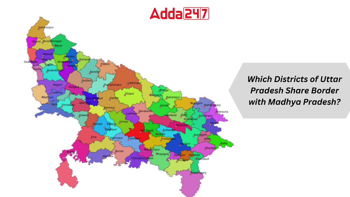
Uttar Pradesh stands as the fourth largest state in India, sprawling across an area of 240,928 square kilometers. It boasts the highest number of districts in the country. Uttar Pradesh shares its borders with various states and also with a neighboring country. Let’s delve into which districts of Uttar Pradesh share borders with the state of Madhya Pradesh.
About Uttar Pradesh
Uttar Pradesh, the fourth largest state in India by area, covers a significant portion of the country’s landmass. With a total area of 240,928 square kilometers, it constitutes approximately 7.33% of India’s geographical expanse. Moreover, it holds the distinction of being the state with the highest number of districts. As of the 2011 census, Uttar Pradesh’s population stood at 199,812,341, representing nearly 16% of India’s total population.
Bordering States with Uttar Pradesh
Uttar Pradesh shares its borders with eight states and one union territory. These include Haryana, Madhya Pradesh, Bihar, Chhattisgarh, Jharkhand, Rajasthan, Uttarakhand, and Himachal Pradesh.
How many Districts of Uttar Pradesh share Border with Madhya Pradesh?
In Uttar Pradesh, a total of 11 districts share borders with Madhya Pradesh, highlighting the significant geographical connection between the two states. These districts, including Agra, Etawah, Jalaun, Jhansi, Lalitpur, Mahoba, Banda, Chitrakoot, Prayagraj (formerly Allahabad), Mirzapur, and Sonbhadra, play a crucial role in facilitating cultural and economic exchanges, as well as promoting interstate connectivity and cooperation.
Districts Sharing Borders with Madhya Pradesh
Now, let’s explore which districts of Uttar Pradesh share their borders with Madhya Pradesh. Uttar Pradesh shares its boundaries with Madhya Pradesh through the following districts:
- Agra
- Etawah
- Jalaun
- Jhansi
- Lalitpur
- Mahoba
- Banda
- Chitrakoot
- Prayagraj (formerly Allahabad)
- Mirzapur
- Sonbhadra


 Which Lake is known as the Jewel of Udai...
 Which is the Largest Banana Producing St...
 Which is the First Tiger Reserve of Utta...


