Did you know that some rivers in India are famous not just for their size, but also for their unusual colour? One special river is often called the Black River of India because its water looks dark compared to other rivers. Many rivers carry clear or muddy water, but this river flows over dark rocks and soil.
Because of this, the water appears almost black, especially during certain seasons. People living near the river have created stories and traditions around it. For them, it is not just a water source but also a part of their culture and daily life.
The river also supports farming, wildlife, and towns along its banks. It has played an important role in shaping settlements for centuries.
Today, travellers and geography lovers remain curious about this unique river and the reason behind its mysterious name.
Which River is known as the Black River of India?
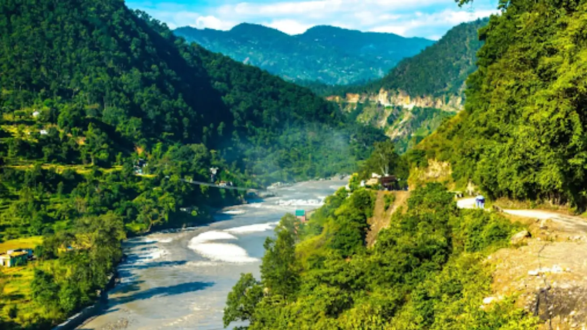
The Kali River, also called the Sharda or Mahakali River, is known as the Black River of India. It rises in the Kalapani area of Uttarakhand in the Himalayas. The river gets its name because its water often looks dark due to deep mountain shadows, black rocks, and mineral-rich soil. For a long distance it forms the natural border between India and Nepal. After entering the plains, it joins the Ghaghara River and supports farming, irrigation, and daily life of nearby people.
Why is the Kali River called as the Black River?
The word Kali means black in Sanskrit and is also the name of the powerful Hindu Goddess Kali. The river got this name mainly because:
- Its water often appears dark due to deep gorges and shadows in the Himalayas
- The flow carries dark silt and minerals from mountain rocks
- In some places, the surrounding black stones make the water look darker
- Locals connect the river spiritually with Goddess Kali
Because of these reasons, people started calling it the Black River.
Origin of the Kali (Sharda) River
The river begins high in the Himalayas.
- Source: Kalapani region, Pithoragarh district, Uttarakhand
- Height: Around 3,600 metres above sea level
- Mountain Region: Greater Himalayas
In its early stage, the river flows through narrow valleys and freezing cold areas formed by glaciers.
Course and Journey of the River
- Forms an International Border: For a long distance, the river acts as a natural boundary between India and Nepal. Many towns from both countries depend on it for water and trade.
- Enters the Plains: When it reaches Tanakpur, the river becomes wider and calmer. From here, it is mostly known as the Sharda River.
- Final Meeting: After travelling across the Terai region of Uttar Pradesh, it finally joins the Ghaghara River, which later merges with the Ganga.
Importance of the Kali River
- Lifeline for Agriculture: The river feeds the famous Sharda Canal system, one of the largest irrigation networks in northern India. It turns dry land into fertile farmland.
- Source of Electricity: Because the river flows quickly from mountains to plains, it has great hydroelectric power potential. Several dam projects are planned and built on it.
- India–Nepal Cooperation: Under the Mahakali Treaty, both India and Nepal share water and electricity benefits from the river.
Another Black River in India
Interestingly, there is also a Kali River in Karnataka called the Black River.
- Originates in the Western Ghats
- Flows through Dandeli forests
- Dark colour comes from manganese-rich rocks
- Ends in the Arabian Sea near Karwar
- Supports dams like Supa Dam
So India actually has two rivers popularly linked with the Black River name, but the Himalayan Kali-Sharda River is the most historically recognised one.
Key Facts About the Kali River
- Declared India–Nepal border in the Sugauli Treaty (1816)
- Extremely fast-flowing mountain river
- Changes course during heavy monsoon
- Important for irrigation and power generation
- Connects different ecosystems of the Himalayas and plains

 Where is the Strait of Hormuz Located?
 Best Airlines in the World 2026: Best Fu...
 Who Invented the QR Code? Check Here