
Kerala, often referred to as “God’s Own Country,” is a picturesque state located at the southern tip of the Indian subcontinent. It stretches along a sun-drenched coastline bordered by the Arabian Sea to the west and the Western Ghats to the east. Known for its lush landscapes, rich culture, and high literacy rates, Kerala is a unique blend of natural beauty and modern development.
An Overview of Kerala State
Formed on November 1, 1956, Kerala is a small but vibrant state encompassing 1.18% of India’s total area. The capital city is Thiruvananthapuram, and Malayalam is the principal language spoken. The state is renowned for its annual festival, Onam, and its distinctive state symbols, including the elephant as the state animal, the hornbill as the state bird, the Kanikkonna (Cassia Fistula) as the state flower, and the coconut tree as the state tree.
Geographical Significance of Kerala
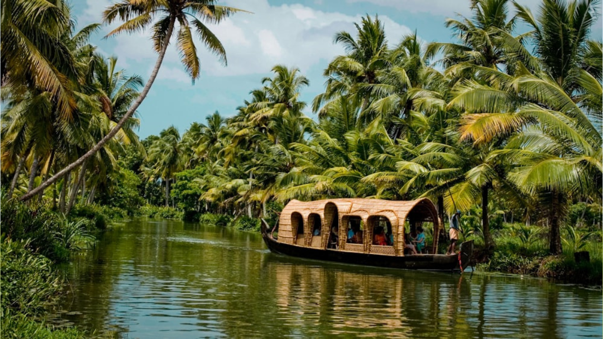
Kerala’s geography is characterized by its distinctive regions: the hilly Western Ghats, the midland plains, and the coastal region. The Western Ghats, which form a natural barrier, contribute to the state’s diverse climate and biodiversity. The state is also known for its backwaters, which are a major tourist attraction.
Administrative Divisions of Kerala State
Kerala is divided into 14 districts, which are further subdivided into 63 taluks and 1,453 villages. The administrative structure includes 21 revenue divisions and 999 panchayats. The state also has 53 municipalities, 5 municipal corporations, 14 district panchayats, and various development blocks. In terms of representation, Kerala has 140 assembly seats, 20 Lok Sabha seats, and 9 Rajya Sabha seats.
Area of Kerala
Kerala covers an area of 38,863 square kilometers. It stretches along a coastline of approximately 580 kilometers and has a width varying from 35 to 120 kilometers. The Western Ghats form the eastern boundary of the state, rising to elevations between 1,500 and 2,500 meters above sea level, and the land slopes westward into the plains and the Arabian Sea.
Population of Kerala
As of 2011, Kerala’s population stands at 34,630,192, ranking it 13th among Indian states. The population density is 890 people per square kilometer. The urban population constitutes 47.7% of the total, while 52.3% reside in rural areas. This demographic distribution highlights the state’s balanced urban-rural composition and its growing population density.
Education and Literacy of Kerala
Education is a priority in Kerala, reflected in its high literacy rate of 90.92%. The state has a robust educational infrastructure, including 38 educational districts and 161 sub-educational districts. Kerala boasts 7 universities and 2 deemed universities. The state has made significant strides in education, contributing to its high literacy rates and overall development.


 Which is the Most Consumed Beverage in t...
 Which is the Only Continent with No Tree...
 Which River is known as the National Riv...


