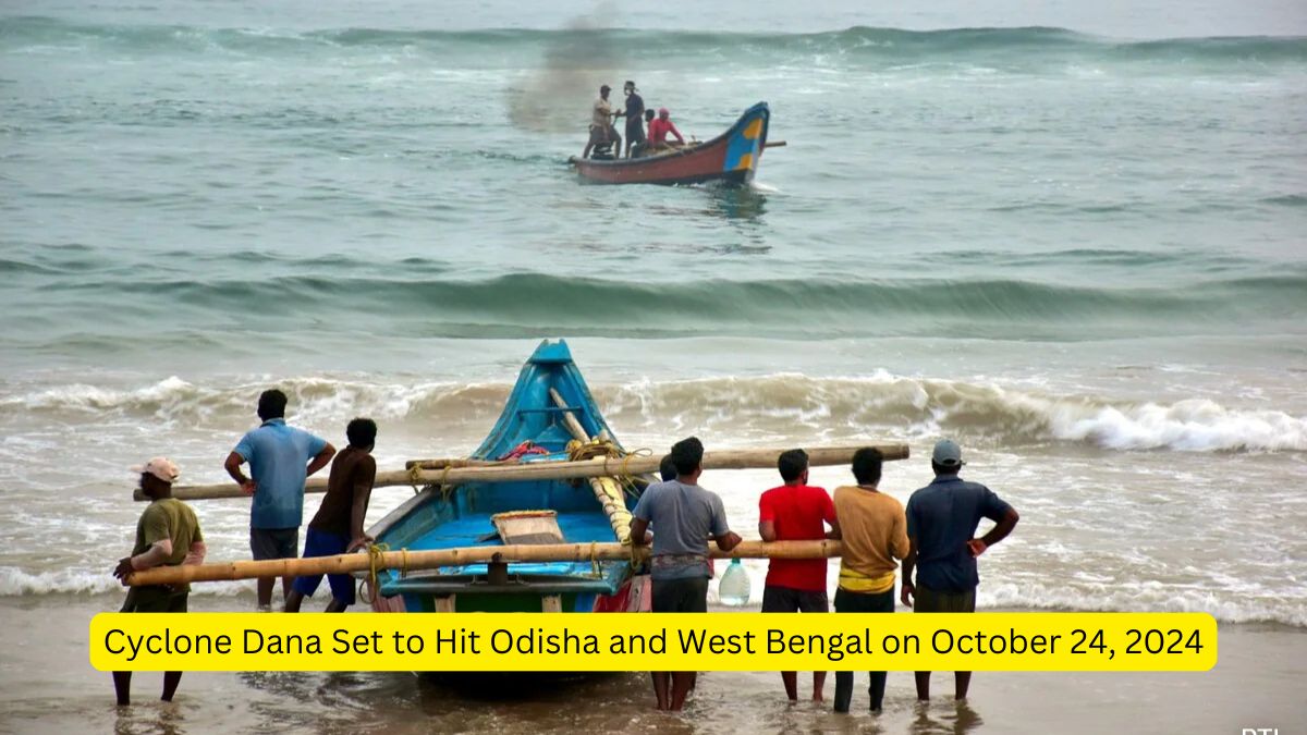
The Indian Meteorological Department (IMD) has issued a warning regarding a low-pressure area over the Bay of Bengal, predicting it will intensify into a severe cyclonic storm by October 23. The storm is expected to make landfall along the coasts of Odisha and West Bengal on October 24. It is likely that Cyclone Dana will bring heavy rains in both states for at least three days.
Information about Cyclones
There are two types of cyclones
- Tropical cyclones
- Extra Tropical cyclones (Temperate cyclones)
About Tropical Cyclones
- Violent storms originating over tropical oceans, moving towards coastal areas causing destruction.
- Destruction due to Violent winds (squalls), Heavy rainfall (torrential), Storm surge.
- Involves closed circulation of air around a low-pressure center.
- Whirling motion caused by rapid upward movement of hot air influenced by Coriolis force.
Conditions Favorable for Formation
- Large sea surface with temperatures higher than 27°C.
- Coriolis force must be strong enough to create a cyclonic vortex.
- Small variations in vertical wind speed.
- Pre-existing weak low-pressure area.
- Upper divergence above sea level.
- Good latent heat source from ocean water.
Origin Process
- Multiple thunderstorms form over oceans under favorable conditions.
- Thunderstorms merge, creating an intense low-pressure system with warm, lighter winds.
Early Stage of Development
- Air in thunderstorms is uplifted as it is warm and light.
- Due to lapse rate and adiabatic lapse rate, air cools, and moisture condenses.
- Latent heat of condensation is released, making the air warmer and lighter, causing further uplift.
- The cycle repeats as moisture is continuously supplied from the ocean.
- Cyclonic vortex forms due to Coriolis force, spiraling around a low-pressure area.
Eye Formation
- The vortex leads to the formation of the eye at the center of the cyclone.
- Centripetal force pulls air toward the center, while opposing centrifugal force creates the calm eye region.
- The eye wall is the most violent part of the cyclone, with maximum wind speeds.
Mature Stage of a Cyclone
- Multiple convective cells form, creating calm and violent regions alternately.
- Rain bands (cumulonimbus clouds) cause intense rainfall, with calm air subsiding between the bands.
- Cloud formation is dense at the center and decreases towards the periphery.
- Cirrus clouds are found at upper levels, composed of ice crystals.
- Dry air descends at the cyclone’s periphery and the eye region.
Structure of a Tropical Cyclone
Eye
- The center of the cyclone with light winds, fair weather, and little precipitation.
- Warmest temperatures aloft and lowest surface pressure.
- Diameter ranges from 8 km to 200 km, with an average of 30-60 km.
Eye Wall
- Surrounds the eye and contains the highest surface winds.
- Strong upward flows due to updrafts and downdrafts.
- Adiabatic warming occurs due to subsiding air.
Spiral Bands
- Long, narrow rain bands spiral towards the center.
- High low-level convergence and upper-level divergence along the bands.
- The bands bring warm, moist air upward, with subsidence occurring outside and within the cyclone.
Regional Names for Tropical Cyclones
- Indian Ocean: Cyclones
- Atlantic Ocean: Hurricanes
- Western Pacific & South China Sea: Typhoons
- Western Australia: Willy-willies
About Temperate Cyclones
- Temperate cyclones, also known as middle latitude cyclones or extra-tropical cyclones, are large-scale low-pressure systems that develop in the mid-latitudes between 30° and 60° N and S.
- They form as a result of the interaction between warm tropical air masses and cold polar air masses.
Polar Front Theory
- The boundary or discontinuity that separates the warm, moist tropical air from the cold, dry polar air.
- At this front, the cold polar air tends to push underneath the warm air, forcing the warm air to rise. The lifting of warm air creates a low-pressure zone, drawing in air from the surrounding areas.
- Coupled with the Earth’s rotation, this system begins to spin, and the Coriolis force directs this cyclonic movement. In the Northern Hemisphere, the circulation is anticlockwise, while in the Southern Hemisphere, it is clockwise.
Stages of Temperate Cyclone Development
Initial Stage
- A disturbance along the polar front occurs, with cold air moving southward and warm air moving northward.
- This forms a wave-like structure in the front, setting up a low-pressure system.
Mature Stage
The cyclone becomes well-developed with two distinct fronts:
- Warm front: The boundary where warm air is moving upward over cold air.
- Cold front: The boundary where cold air is advancing and forcing warm air upward.
- The warm sector of air is wedged between the advancing cold air and retreating cool air.
- Clouds and precipitation appear along the fronts:
- Stratus clouds and light precipitation ahead of the warm front.
- Cumulus and cumulonimbus clouds, with heavier rainfall, along the cold front.
Occluded Stage
- The cold front moves faster than the warm front and eventually overtakes it, lifting the warm air entirely off the ground.
- This creates an occluded front, where the warm sector is pinched off, and the cyclone begins to weaken and dissipate.
Path and Movement
- Temperate cyclones generally move from west to east due to the influence of westerlies and jet streams.
- The specified path is controlled by the orientation of the polar jet stream in the upper troposphere.
- They typically last for 3 to 10 days, and their movement affects large regions.
Characteristics of Temperate Cyclones
Size and Shape
- The temperate cyclones are asymmetrical and shaped like an inverted ‘V’.
- They stretch over 500 to 600 km.
- They have a height of 8 to 11 km.
Wind Velocity And Strength
- The wind strength is more in eastern and southern portions, more over North America compared to Europe.
- The wind velocity increases with the approach but decreases after the cyclone has passed.
Orientation And Movement
- Jet stream plays a major role in temperate cyclogenesis.
- Jet streams also influence the path of temperate cyclones.
| Summary/Static | Details |
| Why in the news? | Cyclone Dana Set to Hit Odisha and West Bengal |
| Types of Cyclones | 1. Tropical Cyclones 2. Extra-Tropical Cyclones (Temperate Cyclones) |
| Tropical Cyclones | – Violent storms from tropical oceans, causing destruction.
– Involves squalls, heavy rainfall, and storm surges. |
| Temperate Cyclones | – Occur between 30° and 60° N/S; formed from interaction of warm tropical and cold polar air. |
| Eye Formation | – Calm center (eye) due to centripetal and centrifugal forces. |
| Cyclone Structure | – Eye (calm, warmest region).
– Eye Wall (strongest winds). – Spiral Bands (narrow rain bands spiraling inward). |
| Regional Names | – Indian Ocean: Cyclones, Atlantic: Hurricanes, Pacific: Typhoons, etc. |


 Ashwini Bhide Becomes First Woman BMC Co...
 Lok Sabha Passed Resolution For Amravati...
 Meghalaya Partners with Starlink India t...


