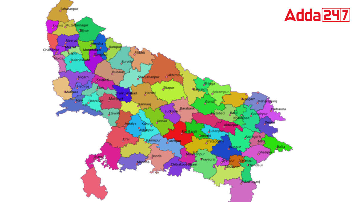
Uttar Pradesh, the most populous state in India, is known for its rich cultural heritage, unique traditions, and vibrant history. It attracts a large number of domestic and international tourists every year. With an area of 240,928 square kilometers, it is the fourth largest state in India by area, making up 7.33% of the country’s total area. Uttar Pradesh also has the distinction of having the highest number of districts in the country.
Overview of Uttar Pradesh
Uttar Pradesh is divided into 75 districts, which are grouped into 18 divisions and 4 regions. The state features 822 community development blocks, 17 municipal corporations, and 350 tehsils (as of 2018). The easternmost district is Ballia, the northernmost is Saharanpur, the southernmost is Sonbhadra, and the westernmost is Shamli.
What is Baghelkhand Region?
Baghelkhand is a region in central India, primarily located in the northeastern part of Madhya Pradesh. It historically encompasses a portion of Uttar Pradesh as well. The region is named after the Baghela Rajputs, who ruled this area in the past. Baghelkhand is rich in mineral and economic resources but is considered less developed compared to western Uttar Pradesh.
Districts of Uttar Pradesh included in Baghelkhand
In Uttar Pradesh, Baghelkhand includes:
- Sonbhadra District: Known for its mineral wealth, Sonbhadra is a significant part of the Baghelkhand region. It is famous for its power plants and natural resources.
- Eastern Part of Prayagraj District: A portion of the Prayagraj district, specifically its eastern part, is considered part of Baghelkhand. Prayagraj, formerly known as Allahabad, is historically and culturally significant in Uttar Pradesh.
Economic Developmental Aspects
Despite its rich resources, the Baghelkhand region in Uttar Pradesh is considered less developed compared to other parts of the state, particularly the western region. This disparity has led to demands for the creation of a separate state to address the unique developmental needs of Baghelkhand.


 Which Lake is known as the Jewel of Udai...
 Which is the Largest Banana Producing St...
 Which is the First Tiger Reserve of Utta...


