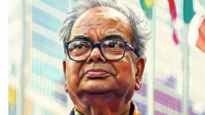
Geospatial Hackathon Launched by Dr. Jitendra Singh
Dr. Jitendra Singh, the Union Minister for Science and Technology, launched the Geospatial Hackathon to encourage innovation and start-ups in India’s geospatial ecosystem. Speaking at the event in New Delhi, Dr. Singh stated that the hackathon’s goal was to encourage collaborations between the public and private geospatial sectors as well as to develop the nation’s environment for geospatial start-ups.
Bank Maha Pack includes Live Batches, Test Series, Video Lectures & eBooks
Geospatial Hackathon to encourage innovation and start-ups in India: Key Points
- To choose the four winners of the Best Solutions to the Geospatial Select Problem Statements, two sets of challenges—the Research Challenge and the Start-Up Challenge—will be presented.
- He continued by saying that the government urgently needs accurate geospatial information for efficient project operation, programme creation, and policy development in order to meet the Sustainable Development Goals.
- The Minister continued by saying that the Narendra Modi administration has undertaken numerous steps to liberalise and democratise the geospatial industry because the space sector would be opened to private investment in 2020.
- The Minister emphasised that India is moving in the direction of promoting ease of doing business throughout the entire geospatial sector with the introduction of the National Geospatial Policy, and that this will catalyse the effort to create a thriving and globally competitive Geospatial ecosystem in India.
SPIC MACAY and Culture Ministry collab on ‘Shruti Amrut’
Geospatial Hackathon: About the Challenge
According to Dr. S Chandrasekhar, secretary of the Ministry of Science and Technology, all contestants will have access to a variety of geospatial datasets related to the problem statements throughout the challenge in order to analyze the data and develop useful tools for data processing, solutions, and servicing.


 Legendary Bengali Author Shankar Passes ...
 List of Dadasaheb Phalke Award Winners f...
 Which Dance Form is known as the Ballad ...


