
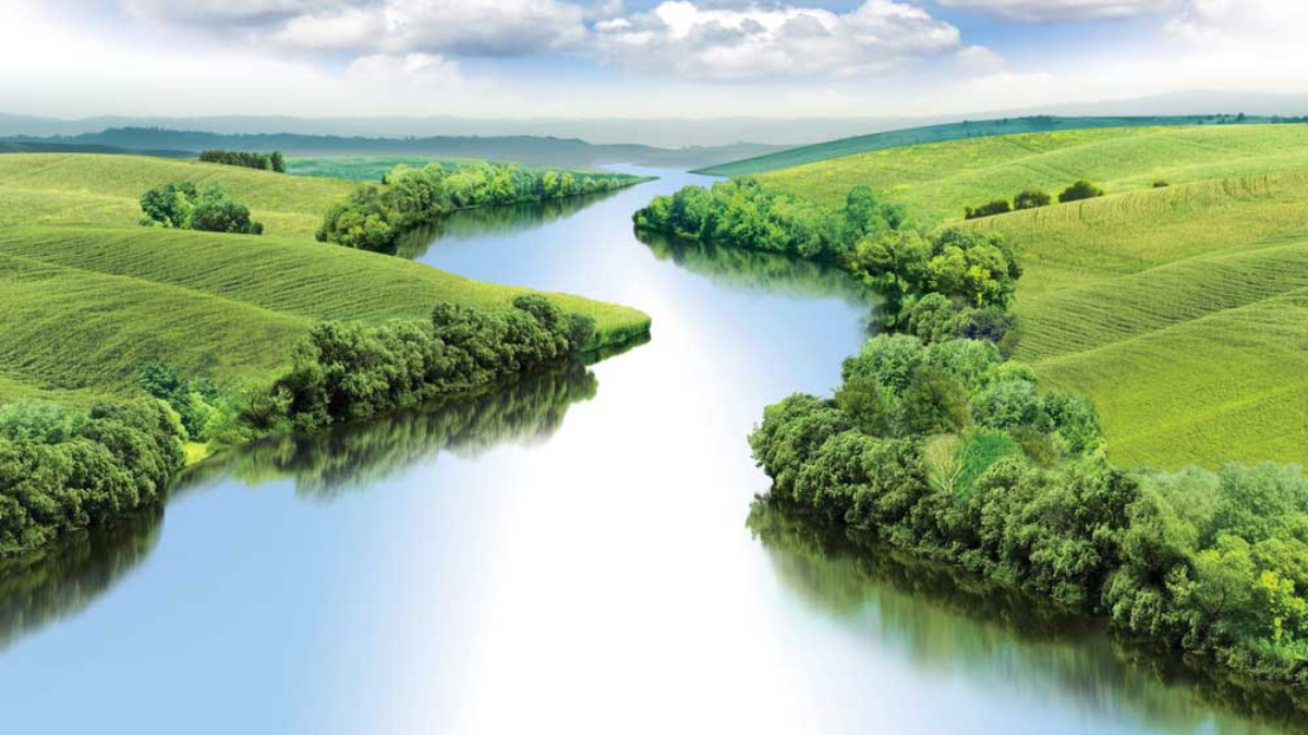
The Narmada River, also known as Reva, Narbada, or anglicised as Nerbudda, holds a prominent place in India’s geographical and cultural landscape. Known as ‘The Giver of Pleasure’ in Sanskrit, it is the fifth-longest river in India and the longest west-streaming river in the country. Flowing through Madhya Pradesh, Maharashtra, and Gujarat, it forms a natural boundary between North and South India.
Origin and Course of the Narmada River
The Narmada River begins at the Narmada Kund, a small reservoir located on Amarkantak Hill in East Madhya Pradesh. This area sits at an elevation of 1,057 meters (3,467.8 feet) above sea level. The river flows westward through Madhya Pradesh, Maharashtra, and Gujarat, traversing between the Vindhya and Satpura hill ranges. It eventually empties into the Gulf of Cambay in the Arabian Sea, approximately 10 kilometers north of Bharuch, Gujarat.
Length and Basin of the Narmada River
With a total length of 1,312 kilometers (815 miles), the Narmada River is the fifth longest river in India. Its basin extends over 98,796 square kilometers, which is nearly 3% of India’s total geographical area. The basin is bordered by the Vindhya ranges to the north, the Maikala range to the east, the Satpura ranges to the south, and the Arabian Sea to the west. Notably, the Tropic of Cancer crosses the upper plains of the Narmada basin.
Tributaries of the Narmada River
The Narmada River is fed by 41 tributaries, with 8 significant tributaries joining from the right bank and 11 from the left bank. Key tributaries include:
Right Bank Territories:
- Hiran: 463.39 km
- Tendori: 601.76 km
- Barna: 604.98 km
- Kolar: 1039.41 km
- Man: 997.58 km
- Uri: 1034.58 km
- Hatni: 1074.81 km
- Osrang: 1190.66 km
Left Bank Territories:
- Burhner: 247.78 km
- Banjar: 286.40 km
- Sher: 497.18 km
- Shakkar: 545.41 km
- Dudhi: 574.41 km
- Tawa: 675.78 km
- Gangli: 756.23 km
- Chhota Tawa: 828.63 km
- Kundi: 942.87 km
- Goi: 1037.8 km
- Karjan: 1198.7 km
Features of the Narmada River
The Narmada River basin covers approximately 3% of India’s geographical area, with a surface area of 98,796 square kilometers. The basin is bordered by the Vindhya Range to the north, the Maikala Range to the east, the Satpura Range to the south, and the Arabian Sea to the west.
- Geographical Spread: The basin includes substantial portions of Madhya Pradesh and Gujarat, and smaller sections of Maharashtra and Chhattisgarh. It encompasses around 27 districts and 20 parliamentary constituencies.
- Water Storage: The basin has a total annual water storage capacity of 45.64 billion cubic meters (BCM), with 34.50 BCM of usable surface water.
- Flood and Summer Widths: At high flood levels, the river’s width can reach 488 meters. During summer, it narrows to 45.70 meters. The river’s flow during the greatest flood this year was 70,847 cumecs, while the summer low was 8.5 cumecs.
Biodiversity of the Narmada River
The Narmada River Basin supports a diverse range of wildlife and plant species. It is home to 76 types of fauna and 276 bird species, none of which are endemic. Approximately 30% of the basin’s area is covered in pristine vegetation, with 5% of this region being protected.
Notable protected areas include:
- Kanha National Park: Located in the upper ranges of the Narmada, it is renowned for its tiger population and rich biodiversity.
- Satpura National Park: Established in 1981 in Hoshangabad, Madhya Pradesh, it is known for its diverse flora and fauna, including tigers, panthers, and various plant species like sal, teak, and bamboo.
Cultural and Spiritual Significance
The Narmada River is deeply embedded in cultural and spiritual traditions. According to legend, a plunge in its waters can absolve sins. The river is frequently mentioned in ancient texts such as the Ramayana, Mahabharata, and various Puranas. It is also believed that the river originated from Lord Shiva’s perspiration, symbolizing purity and sanctity.


 Who is known as the Father of Scientific...
 Which River is known as the River of Lif...
 Who is known as the King of the Deccan?


