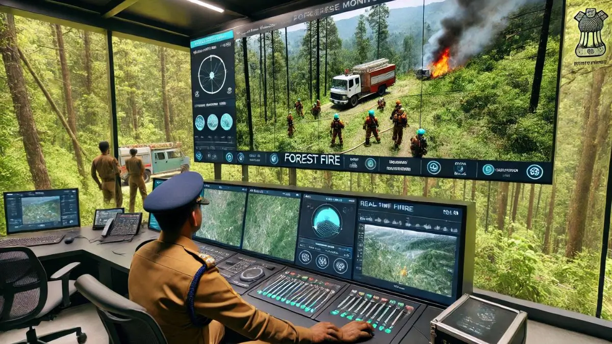
In an effort to combat increasing forest fires, an Indian Forest Service (IFoS) officer from Uttarakhand, Vaibhav Singh, has developed an advanced Forest Fire App. Inspired by technologies used in Canada, Australia, and South Africa, this innovative tool significantly enhances fire detection, response efficiency, and real-time tracking of firefighting teams. The Uttarakhand Forest Department has adopted this app, integrating 7,000 forest staff and planning further expansion.
Key Features
Inspired by Global Practices
- Studied Canada, Australia, and South Africa’s fire mitigation apps.
- Collaborated with an ecologist in Canada for research and development.
Development Process
- Took several years with 31 updates to reach its current advanced state.
- Initially tested in Rudraprayag (2020-2022) before wider implementation.
Watch: Daily Current Affairs
Real-Time Tracking and Response
- Reduces response time to five hours.
- Provides the exact location of the fire with GPS-based tracking.
- Monitors the live location of firefighters and 40 fire-fighting vehicles.
Firefighter and Public Involvement
- 7,000 forest staff currently linked to the app.
- Self-help groups, panchayats, and volunteers will be added in the future.
- Public participation: Common people can geo-tag forest fire locations.
Automated Data Collection and Alerts
- Uses satellite imagery to capture wildfire locations.
- Integrated with the Indian Meteorological Department (IMD) for weather updates.
- Detects the genuineness of incidents and classifies forest types.
Forest Department Integration
- Monitored through the Integrated Command Center dashboard.
- Forest posts and surveillance towers are mapped within the application.
Accountability and Law Enforcement
- Firefighters must be within a 500-meter radius to update information.
- Identifies those responsible for wildfires and the respective forest outpost.
State-Level Implementation and Future Expansion
- Currently implemented in Uttarakhand but may expand to other states if successful.
| Summary/Static | Details |
| Why in the news? | Uttarakhand Officer Leverages Technology to Prevent Forest Fires |
| Developer | IFoS Officer Vaibhav Singh (Haridwar DFO) |
| Development Timeline | Several years; 31 updates |
| Global Inspiration | Studied apps from Canada, Australia, South Africa |
| Initial Testing | Rudraprayag (2020-2022) |
| Key Features | Fire location tracking, real-time monitoring, satellite alerts |
| Response Time | Reduced to 5 hours |
| Current Users | 7,000 forest staff linked |
| Future Expansion | Will include self-help groups, panchayats, volunteers |
| Public Participation | Citizens can geo-tag fire locations |
| Tech Integration | Uses satellite imagery and IMD weather data |
| Command Center | Integrated dashboard for statewide monitoring |
| Law Enforcement | Tracks culprits responsible for wildfires |

 Why Chapchar Kut Is Mizoram’s Most Impor...
 Indiramma Family Life Insurance Scheme A...
 How Tamil Nadu Overtook Gujarat to Lead ...