
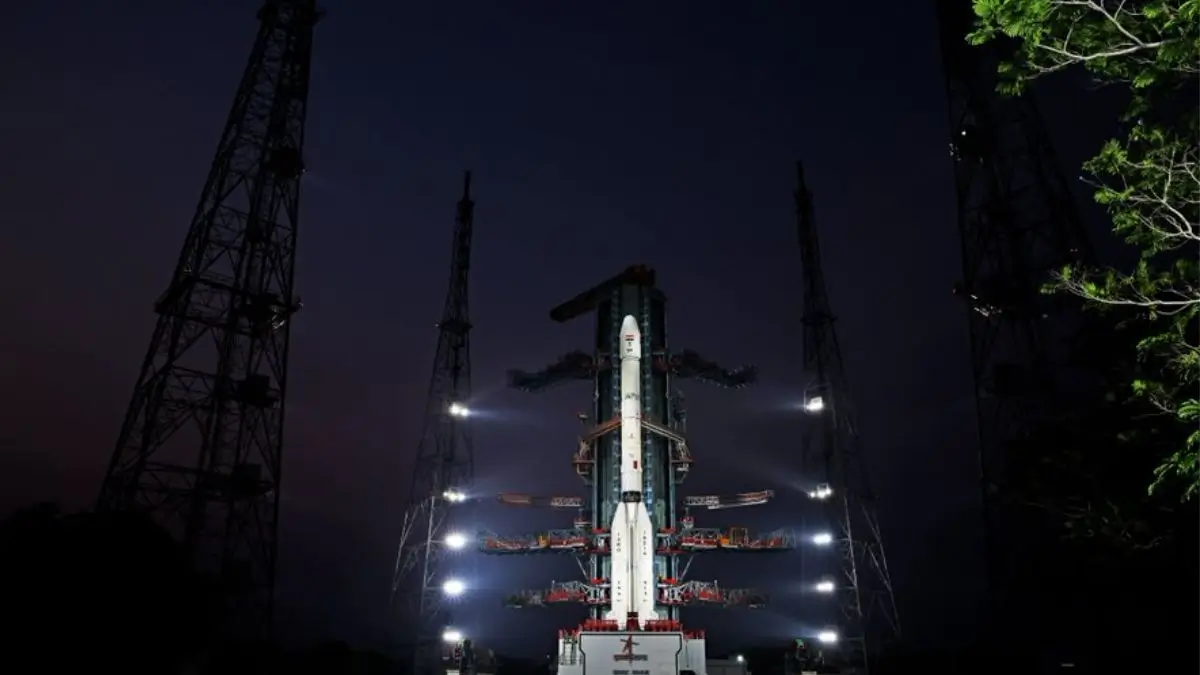
The GSLV-F18 rocket carrying the NVS-03 navigation satellite was successfully launched by the ISRO (Indian Space Research Organization) from the Satish Dhawan Space Center in Sriharikota on October 30 2026. The launch time was 11:51 pm IST, after which ISRO announced the successful placing of the satellite in its intended orbit. NVS-03 is the third satellite in the NavIC series of the second generation, designed to increase India’s capability in positioning, navigation, and timing.
Key Information on ISRO’s GSLV-F18/NVS-03 Mission
ISRO carried out the GSLV-F18 with the NVS-03 satellite onboard at 11:51 PM IST on October 30 2026 from the Satish Dhawan Space Center, Sriharikota, Andhra Pradesh.
The mission was successful when the satellite was placed into the desired orbit. The launch represented another achievement in India’s efforts towards developing its own satellite navigation system.
The GSLV-F18 is a three-stage rocket launcher. The launch process consisted of a solid-propellant core stage with four liquid-propellant strap-on boosters, a second stage that is liquid fuel-based, and a third or an upper stage that is cryogenic.
The cryogenic stage uses liquid hydrogen and oxygen as propellants and supplies necessary thrust for positioning the satellite in the intended transfer orbit.
After separating from the launch vehicle, the satellite will undertake orbit-raising maneuvers to get into its operational orbit.
What Is NVS-03 Satellite?
NVS-03 is the third satellite of ISRO’s second-generation Navigation Satellite series specifically developed to support Navigation with Indian Constellation (NavIC).
The NVS series has been designed to ensure uninterrupted, reliable and accessible satellite navigation services to India.
These second-generation satellites have been designed with improved capabilities to enhance navigation services such as providing additional frequencies such as L1.
L1 is particularly useful for ensuring compatibility with navigation systems used in civil applications.
The NVS-03 satellite should help strengthen the current NavIC constellation and aid recovery of autonomous positioning services.
What Is NavIC?
Navigation with Indian Constellation (NavIC) is a national independent satellite navigation system used for providing Positioning, Navigation and Timing (PNT) services. It was previously known as the Indian Regional Navigation Satellite System (IRNSS) and has been developed by ISRO.
NavIC provides Positioning, Navigation and Timing services to users within India and the surrounding region.
The satellite system will provide services across India and up to approximately 1,500km beyond the country.
The system provides services for civil and strategic applications.
Major Applications of NavIC
- Transportation – Can provide navigation across a range of transport sectors including road, rail, sea and air.
- Disaster Management – Can be used to help aid disaster and emergency coordination.
- Fisheries – Can be used to aid fishermen.
- Military/Strategic – Provides an independent navigation system for strategic users.
- Telecommunications – Can provide precise timing needs.
- Personal navigation – Can provide location-based services.
Why is NVS-03 Required by NavIC?
NavIC has experienced difficulties in operation due to satellite failures, exhaustion of the lifespan of some satellites and also issues related to the onboard atomic clock. This is because it is important as satellite navigation relies on measuring the time taken for signal transmission between satellites and the receiver.
According to an answer provided by the Department of Space to Parliament on July 29, 2026, there were only three functioning satellites namely IRNSS-1B, IRNSS-1I and NVS-01 offering the PNT services. The government has said that for basic stand-alone positioning, four functioning satellites are necessary and so NavIC could not offer this at the time.






 Who Is Anil Menon? NASA Astronaut Comple...
 Ebola Vaccine Trial Begins in DR Congo: ...
 ISRO to Have Four Functional Launch Pads...