
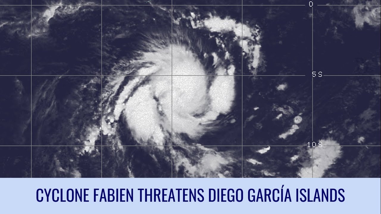
Tropical Cyclone Fabien moved southeast of Diego Garcia on Wednesday morning, 17th April 2023. At 5:00 p.m. EDT on Wednesday, the center of Tropical Cyclone Fabien was located at latitude 9.0°S and longitude 73.6°E, approximately 145 miles (235 km) southeast of Diego Garcia. Fabien was moving toward the southwest at a speed of 6 mph (10 km/h). The maximum sustained wind speed was 110 mph (175 km/h), with wind gusts reaching 130 mph (210 km/h). The minimum surface pressure was recorded at 959 mb.

Tropical Cyclone Fabien: Weakening Signs and Weather Conditions
Tropical Cyclone Fabien began to show signs of weakening on Wednesday morning. The clockwise circulation around Fabien was pulling drier air into the western side of the tropical cyclone, resulting in the weakening of thunderstorms in the western half. Some bands consisted mainly of showers and lower clouds, and the former circular eye was no longer visible on satellite images. However, bands of showers and thunderstorms persisted in the eastern half of Fabien’s circulation, generating upper-level divergence that pumped mass away from the southeast of the cyclone.
Tropical Cyclone Fabien: Size and Intensity

The circulation around Tropical Cyclone Fabien remained small, with hurricane/typhoon force winds extending out 30 miles (50 km) from the center, and tropical storm force winds extending out 90 miles (145 km) from the center. The Hurricane Intensity Index (HII) for Fabien was 19.2, with a Hurricane Size Index (HSI) of 10.3 and a Hurricane Wind Intensity Size Index (HWISI) of 29.5. Fabien was similar in size and intensity to Hurricane Zeta when it hit Louisiana in 2020.
Buy Prime Test Series for all Banking, SSC, Insurance & other exams
Tropical Cyclone Fabien: Future Track and Intensity
Tropical Cyclone Fabien is expected to move through an environment unfavorable for intensification in the next 24 hours. While the Sea Surface Temperatures are near 28°C, southerly winds on the western side of the circulation will continue to bring in drier air, and the cyclone will experience vertical wind shear due to northwesterly winds blowing toward the top of its circulation. These factors will cause Fabien to weaken over the next 24 hours.
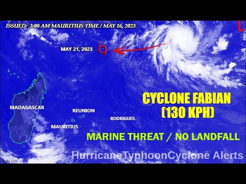
Fabien will be steered by a high-pressure system over the South Indian Ocean, moving it toward the west-southwest in the next 24 hours. The center of the cyclone is expected to pass south of Diego Garcia during this time. Later in the week, the high-pressure system will steer Fabien more toward the west, and it is forecasted to move southwest of Diego Garcia on Thursday.
Tropical Cyclone Fabien Strengthens to Equivalent of a Major Hurricane
Tropical Cyclone Fabien strengthened to the equivalent of a major hurricane over the South Indian Ocean east of Diego Garcia on Tuesday morning. At 11:00 a.m. EDT on Tuesday, the center of Tropical Cyclone Fabien was located at latitude 7.6°S and longitude 74.8°E, approximately 180 miles (290 km) east of Diego Garcia. Fabien was moving toward the southwest at 8 mph (13 km/h). The maximum sustained wind speed was 115 mph (185 km/h), with wind gusts up to 145 mph (230 km/h). The minimum surface pressure was recorded at 956 mb.
Tropical Cyclone Fabien: Rapid Intensification and Current State
Tropical Cyclone Fabien rapidly intensified to the equivalent of a hurricane/typhoon over the South Indian Ocean on Sunday. By Sunday night, a small circular eye with a diameter of 15 miles (24 km) had formed at the center of the storm.
Also Read: India & Bangladesh launch ’50 Start-ups Exchange Programme‘
Find More Miscellaneous News Here


 Current Affairs Capsule PDF (14 July, 20...
 Ladakh to Get Autonomous Hill Councils i...
 MeitY Releases Digital Threat Report 202...

