
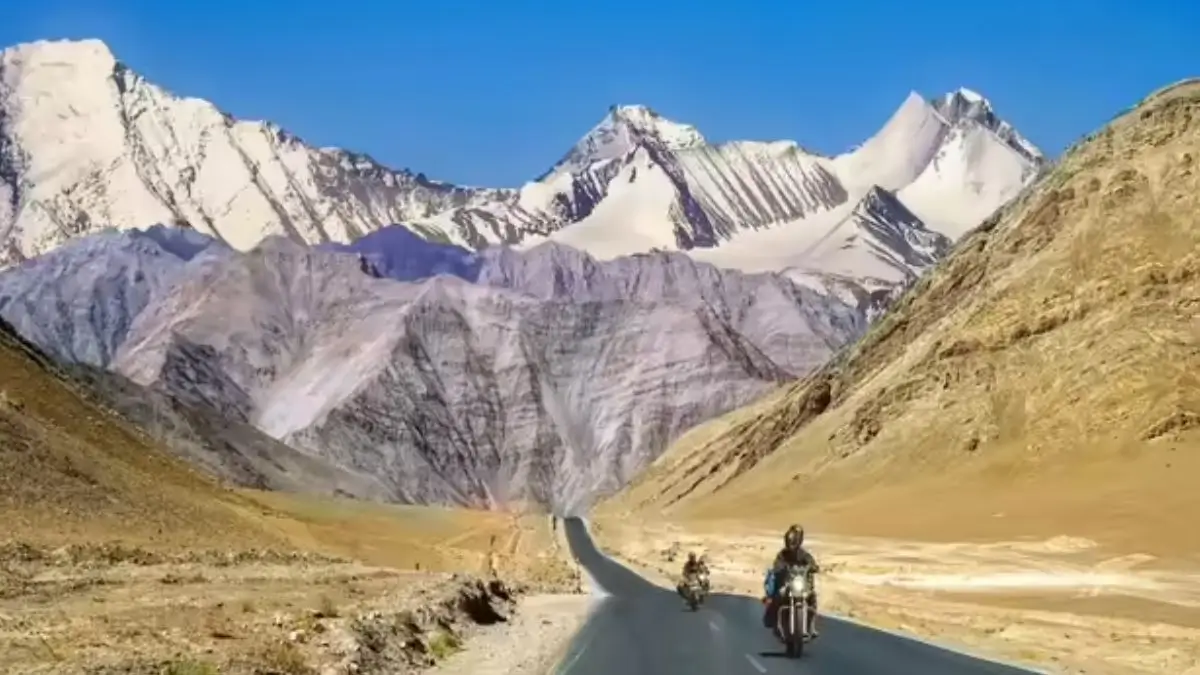
Government of India, along with the Union Territory of Ladakh, has officially named 28 geographical locations and features in Ladakh according to standard place and feature names on the Survey of India (SoI) map. This is done to make sure that these places and features can be accurately recognized and to increase their public knowledge. The features identified are peaks, mountains, passes, glaciers, valleys, rivers, lakes, water bodies and other geographical features.
28 Places and Features Named on the Survey of India Map
These 28 places and features belong to different categories of geographical features in the Union Territory of Ladakh.
Peaks
The following places have been identified as peaks,
- Atisha Giri
- Kanishka Peak
- Martand Giri
- Zorawar Peak
- Rinchen Zangpo
- Sakyasri Giri
- Marpa Lotsava Ri
- Milarepa Kangri
- Shiva Ri
- Maheshvara Ri
Mountains
The following geographical features have been identified as mountains,
- Karun Pir
- Drak Karpo
- Jolmori
Passes
There are only two passes which have been identified as follows,
- Chapchingal Pass
- Shachmirk Pass
Glaciers
These are the only two glaciers which have been identified as follows,
- Parpik Glacier
- Skamri Glacier
Geographical Features Other Than Above Mentioned
These geographical features come under several other categories as follows:
Place and It’sFeature Type
- Brangsa: Land area
- Kuksel: Land area
- Shkorga Valley: Valley
- Dehra Compass: Land area
- Gogra: Land area
- Kumarayana Point: Land area
- Panglung: Land area
- Guru Rinpoche: Lake
- Shamal Lungpa:Land area
- Yangpa River: River
- Hot Spring: Water body
Complete List of 28 Ladakh Features
| No. | Name | Feature Type |
| 1 | Atisha Giri | Peak |
| 2 | Brangsa | Land area |
| 3 | Chapchingal Pass | Pass |
| 4 | Kanishka Peak | Peak |
| 5 | Karun Pir | Mountain |
| 6 | Kuksel | Land area |
| 7 | Martand Giri | Peak |
| 8 | Parpik | Glacier |
| 9 | Skamri Glacier | Glacier |
| 10 | Shachmirk Pass | Pass |
| 11 | Shkorga Valley | Valley |
| 12 | Zorawar Peak | Peak |
| 13 | Dehra Compass | Land area |
| 14 | Drak Karpo | Mountain |
| 15 | Gogra | Land area |
| 16 | Jolmori | Mountain |
| 17 | Kumarayana Point | Land area |
| 18 | Panglung | Land area |
| 19 | Rinchen Zangpo | Peak |
| 20 | Sakyasri Giri | Peak |
| 21 | Guru Rinpoche | Lake |
| 22 | Shamal Lungpa | Land area |
| 23 | Yangpa River | River |
| 24 | Hot Spring | Water body |
| 25 | Marpa Lotsava Ri | Peak |
| 26 | Milarepa Kangri | Peak |
| 27 | Shiva Ri | Peak |
| 28 | Maheshvara Ri | Peak |
Role of the Survey of India
The Survey of India is the national survey organization of India and operates under the Department of Science & Technology, Ministry of Science and Technology.
It includes topographical and geographical data that are used for administrative, planning, developmental, scientific research and various other purposes.
Formal naming of geographical features on the official maps of the nation serves as a standard source of recognizing and depicting them.
Relevance of Updated Map of Ladakh
The identification of these geographical features helps in providing the standardized names for their depiction on the official map of Ladakh by the Survey of India.
It will serve to enhance geographical knowledge as well as serve as a reference point for the relevant authorities, academicians, map makers and general public.
It also showcases the varied geography of Ladakh which includes mountain ranges and peaks, passes, glaciers, valleys, rivers and lakes.






 Delhi Institute for Transformation and I...
 Delhi Cabinet Approves Go-Delhi Foundati...
 Asiatic Lions Return to Barda Wildlife S...