Uttar Pradesh, often referred to as UP, is a state located in the northern part of India. Known for its diverse culture, language, cuisine, rich history, and uniqueness, it attracts a large number of domestic and international tourists every year. It is also renowned for its religious cities, drawing people from far and wide in search of spiritual solace.
Overview of Uttar Pradesh
Formerly known as the United Provinces, Uttar Pradesh was renamed after India gained independence. It was officially formed on January 24, 1950, and since then, Uttar Pradesh Day is celebrated annually on this date. In the year 2000, one of its regions was carved out to create a separate state named Uttarakhand. Uttar Pradesh covers an area of 240,928 square kilometers, accounting for 7.33% of India’s total land area. Presently, the state comprises 75 districts, organized into 18 divisions, with a total of 822 development blocks, 17 municipal corporations, and 351 tehsils.
How many States does Uttar Pradesh Share its Boundary With?
Uttar Pradesh shares its border with a total of 8 states and one Union Territory (UT), along with international boundaries.
Uttar Pradesh shares its borders with Himachal Pradesh, Uttarakhand, Rajasthan, Madhya Pradesh, Bihar, Jharkhand, Chhattisgarh, and Haryana. Additionally, it shares its boundary with the UT of Delhi. Furthermore, it shares an international border with Nepal.
Districts of Uttar Pradesh Bordering Haryana
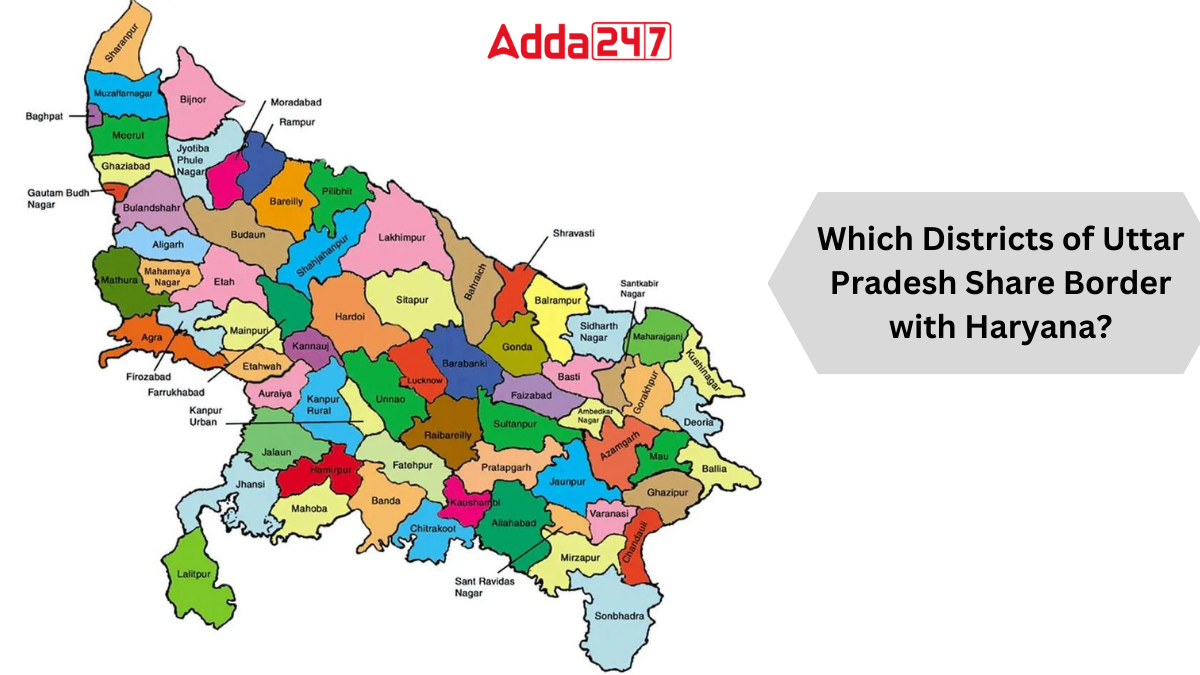
Six districts of Uttar Pradesh share their borders with Haryana, namely:
- Saharanpur
- Shamli
- Baghpat
- Gautam Buddha Nagar
- Aligarh
- Mathura
These districts serve as significant points of contact between Uttar Pradesh and Haryana, facilitating cultural, economic, and social exchanges between the two states.


 Which District is known as the Medical C...
 Which was the First Women's University i...
 Which Island is known as the Island of P...


