
The Earth is covered with imaginary lines called latitudes and longitudes that help us locate places easily on a map or globe. Each line of latitude circles the planet from east to west, but their lengths are not the same. Some are shorter, while one stands out as the longest line of latitude on the globe — let’s explore and find out which one it is.
What are Lines of Latitude?
Lines of latitude are horizontal circles drawn on maps and globes.
They measure the distance of any place north or south from a central line. Each line of latitude is expressed in degrees (°), ranging from 0° at the center to 90° at the poles.
These lines are also called parallels, as they run parallel to each other. They help travelers, scientists, and geographers pinpoint locations and study the Earth’s surface accurately.
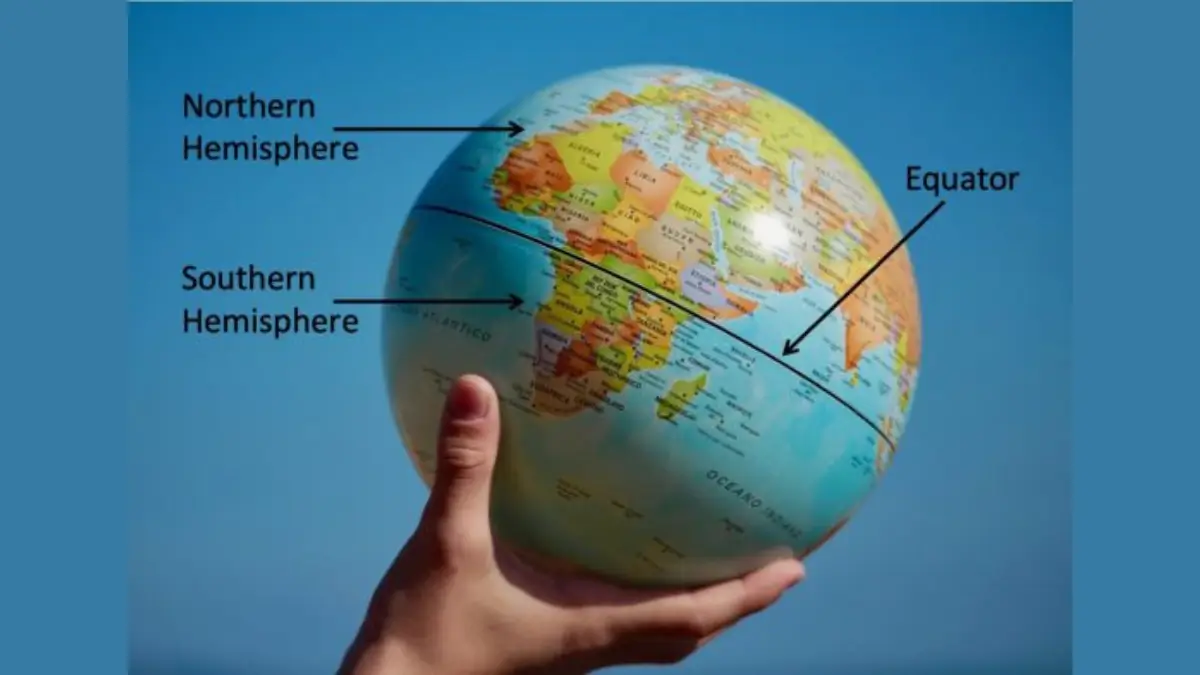
The Longest Line of Latitude
The Equator is the most important and longest line of latitude on the Earth. It is located at 0° latitude and divides the Earth into two equal halves — the Northern Hemisphere and the Southern Hemisphere.
Because the Earth is slightly wider at the center, the Equator forms the largest circle around the planet. It serves as a natural reference line for measuring distances north and south.
Length of the Equator
The Equator is not just special — it’s also the widest and longest of all latitude lines.
Total length: About 40,075 kilometers (24,901 miles)
This makes it the largest circle around Earth. As we move away from the Equator toward the North or South Poles, the circles become smaller and smaller until they meet at a single point at each pole. That’s why the Equator is unique — it is the only latitude line that completely circles the Earth at its widest part.
Climate Around the Equator
The regions near the Equator are known for their tropical climate. Because sunlight falls almost directly overhead throughout the year, these areas experience:
- High temperatures
- Heavy rainfall
- Lush rainforests and diverse wildlife
Countries near the Equator often have equal day and night lengths all year long. The Equator also influences global wind and rainfall patterns, making it a key factor in studying the world’s weather.
Why is the Equator Important?
The Equator is much more than a simple line on the globe. It has several important uses and roles:
- Geographical Reference: It divides Earth into two hemispheres, helping in location mapping.
- Navigation: Sailors and pilots use it as a main reference for direction and distance.
- Climate Studies: It helps scientists understand how sunlight and temperature affect different regions.
- Ecological Importance: The Equatorial regions are home to rainforests, rivers, and unique wildlife ecosystems.
- Educational and Cultural Value: Many countries near the Equator celebrate their position with monuments and tourism.
Countries the Equator Passes Through
The Equator crosses 13 countries across three continents — South America, Africa, and Asia.
Here’s a look at them:
- Ecuador – The country’s name itself means “Equator.”
- Colombia – Known for its warm equatorial climate.
- Brazil – The Amazon rainforest lies along the Equator.
- Gabon – Covered with rich tropical forests.
- Republic of the Congo – Features dense equatorial vegetation.
- Democratic Republic of the Congo – One of the largest equatorial nations in Africa.
- Uganda – Famous for the Equator monument and wildlife.
- Kenya – Crossed by the Equator near Nanyuki town.
- Somalia – Its southern part touches the Equator.
- Sao Tome and Principe – A small island nation near the Equator.
- Maldives – Located near the Equatorial region of the Indian Ocean.
- Indonesia – A large group of islands straddling the Equator.
- Kiribati – A Pacific island nation crossed by the Equator.


 Weekly Current Affairs One Liners (27th ...
 India's First Telecom Manufacturing Zone...
 Rivers of Jaipur: Complete List of Major...

