
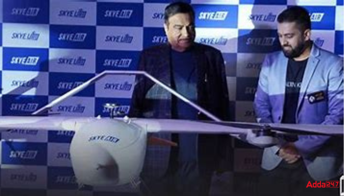
Union Minister for Road Transport and Highways Nitin Gadkari unveiled Skye UTM, which is the most cutting-edge unmanned traffic management system in the world, which is capable of handling 4,000 flights per hour and 96,000 flights per day. Skye UTM is a Cloud-based aerial traffic management system that integrates unmanned air traffic with manned aviation airspace.
Skye Air Launched India’s First Traffic Management System for Drones- Key Points
- Skye UTM has been built towards providing situational awareness, autonomous navigation, risk assessment, and traffic management to all drone/other aerial mobility operators across the airspace.
- Emphasizing new technologies in the construction, infra, and highway sector, Union Minister Nitin Gadkari informed that it is the right time for Indian drone startups to lead the industry.
- These drones are going to be used across sectors including construction, agriculture, healthcare, defense, infrastructure, surveying, real estate, and transport.
- Drone companies will even monitor highways and road construction. There is a lot of research happening that will certainly help scale its usage.
- The Ministry will soon invite participation from drone startups to be deployed for real-time monitoring and speed up highway constructions, and also keep a check on fatal road accidents.
- According to Ankit Kumar, CEO of Skye Air, the requirement for situational awareness has become a necessity for drone pilots, regulators, and controllers who need real-time information about the drones in the sky.
- Skye UTM has supported more than 300 successful BVLOS (Beyond Visual Line of Sight) drone flights to date.
- The Skye UTM captures more than 255 parameters of UAV movements and stores them in its ‘Blackbox’ which is a published systematic description of the entire flight.
- The platform offers the first 3D view of the drone airspace, along with operations and regulations mapping servers which offer the latest airspace status, and verified paths, and display real-time UAV movements.


 Current Affairs Capsule PDF (14 July, 20...
 Ladakh to Get Autonomous Hill Councils i...
 MeitY Releases Digital Threat Report 202...

