
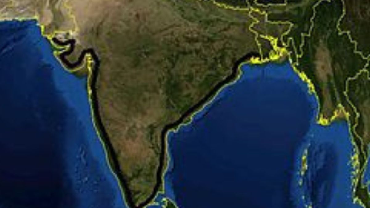
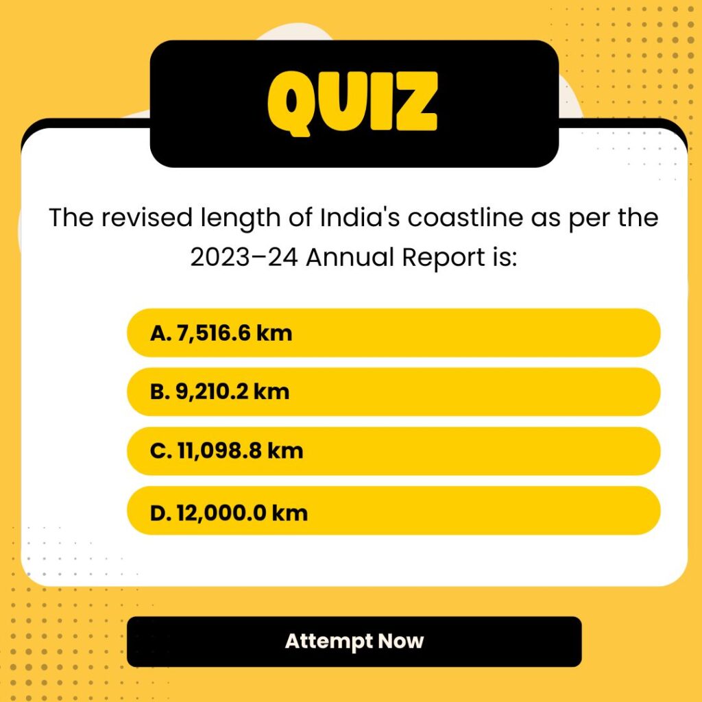
In a landmark update to its geographical metrics, the Government of India has revised the length of its coastline from 7,516.6 km to 11,098.8 km — a nearly 50% increase — without gaining any new land. This revision, announced in the Ministry of Home Affairs’ 2023–2024 annual report, stems not from any territorial expansion but from enhanced mapping technologies that now allow for far more accurate measurement of coastal features. The update marks a significant evolution in India’s geospatial understanding and has major implications for coastal security, climate planning, and economic zone regulation.
Why in News?
The Union Ministry of Home Affairs in December 2024 announced a revision in the official length of India’s coastline. No new land added — the revision is purely due to improved measurement techniques. The updated figures will now be reviewed every 10 years using advanced mapping tools. Old coastline length is about 7,516.6 km and New coastline length 11,098.8 km.
Key Highlights
- Announced by: Ministry of Home Affairs (MoHA), in the 2023–24 Annual Report
- Measured by: Survey of India and the National Hydrographic Office (NHO)
New methodology: Used high-resolution digital tools including,
- Geographic Information Systems (GIS)
- Satellite altimetry
- LIDAR-GPS
- Drone-based imaging
- Base scale used: 1:250,000 (compared to earlier 1:4,500,000)
- Reference line: High Water Line (HWL) from 2011 electronic navigation charts
Understanding the Coastline Paradox
- Concept first identified by Lewis Fry Richardson, expanded by Benoît Mandelbrot
- A coastline’s length increases with finer measurement scales
- Coastlines behave like fractals — highly detailed at every zoom level
- Example: Britain’s coastline can vary from 2,400 km to over 3,400 km depending on scale
Why This Matters
- Maritime security: Longer coastline = longer area to protect
- Exclusive Economic Zones (EEZs): Can be extended based on new boundaries
- Disaster management: Better planning for cyclones, floods, and sea-level rise
- Climate modelling: Improved input data for accurate coastal impact projections
- Textbook changes: School geography curricula need updates
Static GK Facts
- India has 9 coastal States and 4 Union Territories (Andaman & Nicobar and Lakshadweep, Diu Daman and Pondicherry)
- Last coastal state to join India: Goa (1961)
| Summary/Static | Details |
| Why in the news? | From 7,516 km to 11,099 km: India’s New Coastal Length Explained |
| Revised Coastline Length | 11,098.8 km |
| Earlier Measurement | 7,516.6 km |
| Change | Due To Improved geospatial mapping techniques |
| Key Technologies Used | GIS, Satellite Altimetry, LIDAR-GPS, Drones |
| Key Organisations Involved | National Hydrographic Office, Survey of India |
| Reference Line Used | High Water Line (2011 data) |
| Future Plan | Review coastline length every 10 years |
| Related Scientific Concept | Coastline Paradox (Fractal Geometry) |


 IIT Kanpur to Establish Centre of Excell...
 India Unveils First Air Taxi Prototype: ...
 Takeda's QDENGA Becomes India's First Ap...

